
ファイル:Ancient Khorasan highlighted.jpg
Ancient_Khorasan_highlighted.jpg (373 × 320 ピクセル、ファイルサイズ: 58キロバイト、MIME タイプ: image/jpeg)
ウィキメディア・コモンズのファイルページにある説明を、以下に表示します。
|
| 解説 |
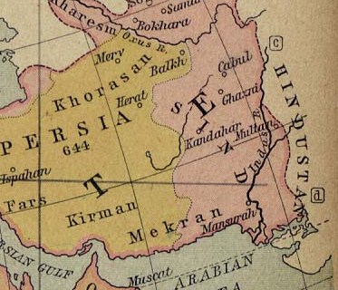
Map showing Ancient Persia in light yellowish and the the land called Sind (most of today's Afghanistan and part of Pakistan) in pinkish. A number of ancient references are made to the names shown in this map. Ibn Batutta writes in 1333 AD: [1]
|
||||
| 日付 | |||||
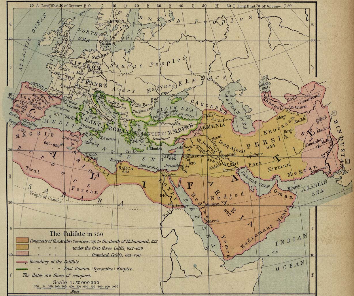
| 原典 | University of Texas at Austin, Middle East and Europe - The Caliphate in 750 (293K) | ||||
| 作者 | William R. Shepherd | ||||
| 許可 (ファイルの再利用) |
|
||||
| その他のバージョン | full version: File:Califate 750.jpg | ||||
ファイルの履歴
過去の版のファイルを表示するには、その版の日時をクリックしてください。
| 日付と時刻 | サムネイル | 寸法 | 利用者 | コメント | |
|---|---|---|---|---|---|
| 現在の版 | 2010年10月22日 (金) 19:07 | | 373 × 320 (58キロバイト) | Officer | {{Information |Description= |Source= |Date= |Author= |Permission= |other_versions= }} |
ファイルの使用状況
以下のページがこのファイルを使用しています:
グローバルなファイル使用状況
以下に挙げる他のウィキがこの画像を使っています:
- an.wikipedia.org での使用状況
- ar.wikipedia.org での使用状況
- arz.wikipedia.org での使用状況
- azb.wikipedia.org での使用状況
- ba.wikipedia.org での使用状況
- bn.wikipedia.org での使用状況
- ca.wikipedia.org での使用状況
- ckb.wikipedia.org での使用状況
- de.wikipedia.org での使用状況
- el.wikipedia.org での使用状況
- en-two.iwiki.icu での使用状況
- Muslim conquests of Afghanistan
- History of Afghanistan
- Kabul
- Al-Mansur
- Muslim conquest of Persia
- Greater Khorasan
- Jewish mythology
- History of Arabs in Afghanistan
- Portal:Afghanistan
- Delhi–Multan road
- Talk:Afghanistan/Archive 8
- Siege of Kabul (1504)
- User:Tisquesusa/sandbox9
- User:Falcaorib
- User:Northamerica1000/Portals of the world
- User:HistoryofIran/Greater Khorasan
- List of sieges of Kabul
- en.wiktionary.org での使用状況
- eo.wikipedia.org での使用状況
- es.wikipedia.org での使用状況
- fa.wikipedia.org での使用状況
このファイルのグローバル使用状況を表示する。