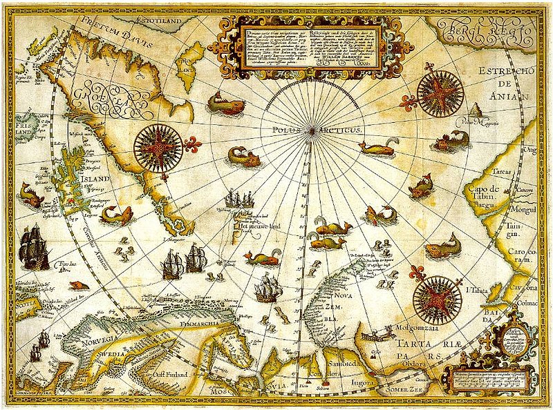
ファイル:Barentsz Full Map.jpg
表示

このプレビューのサイズ: 800 × 594 ピクセル。 その他の解像度: 320 × 237 ピクセル | 640 × 475 ピクセル | 1,000 × 742 ピクセル。
元のファイル (1,000 × 742 ピクセル、ファイルサイズ: 258キロバイト、MIME タイプ: image/jpeg)
ファイルの履歴
過去の版のファイルを表示するには、その版の日時をクリックしてください。
| 日付と時刻 | サムネイル | 寸法 | 利用者 | コメント | |
|---|---|---|---|---|---|
| 現在の版 | 2007年12月5日 (水) 22:20 |  | 1,000 × 742 (258キロバイト) | Sherurcij | {{Information |Description=Portion of 1599 map of Arctic exploration by Willem Barentsz. Spitsbergen, here mapped for the first time, is indicated as "Het Nieuwe Land" (Dutch for "the New Land"), center-left. |Source=[http://www.ub.uit.no/northernlights/e |
ファイルの使用状況
このファイルを使用しているページはありません。
グローバルなファイル使用状況
以下に挙げる他のウィキがこの画像を使っています:
- ar.wikipedia.org での使用状況
- fr.wikipedia.org での使用状況
- gcr.wikipedia.org での使用状況
- kk.wikipedia.org での使用状況
- nrm.wikipedia.org での使用状況
- ru.wikipedia.org での使用状況


