
ファイル:Bari relief location map.svg

この SVG ファイルのこの PNG プレビューのサイズ: 425 × 425 ピクセル. その他の解像度: 240 × 240 ピクセル | 480 × 480 ピクセル | 768 × 768 ピクセル | 1,024 × 1,024 ピクセル | 2,048 × 2,048 ピクセル。
元のファイル (SVG ファイル、425 × 425 ピクセル、ファイルサイズ: 1.07メガバイト)
ウィキメディア・コモンズのファイルページにある説明を、以下に表示します。
|
概要
| 解説 |
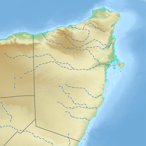
English: Bari region in Somalia 日本語: バリ州 (ソマリア)のLocation map用地図
|
| 日付 | |
| 原典 | See below |
| 作者 | See below (Assembly by User:Freetrashbox) |
Sources
- Global Relief: ETOPO Global Relief Model / NOAA (2022-10-04). Ice surface elevation geotiff. Retrieved on 2022-12-13. / ETOPO_2022_v1_15s_N00W030_surface.tif, ETOPO_2022_v1_15s_N15E030_surface.tif
- International border: GSHHG data version 2.3.7 / NOAA (2017-06-15). Shoreline / Coastline Resources. Retrieved on 2022-12-13. / gshhg-shp-2.3.7\WDBII_shp\h\WDBII_border_h_L1.shp
- Intermittent rivers: GSHHG data version 2.3.7 / ibid. / gshhg-shp-2.3.7\WDBII_shp\h\WDBII_river_h_L08.shp
- Regional border of Somaliland: SOMALILAND VULNERABILITY INDEX MAP / Ministry of Planning and National Development of Somaliland. SOMALILAND VULNERABILITY INDEX MAP. Retrieved on 2022-12-13.
- Regional border of Somalia (without Somaliland): Google map
Design
- Global Relief: Wikipedia:Graphics Lab/Resources/GIS sources and palettes
- International border: R100 G100 B100, 2pts.
- Intermittent rivers: R72 G123 B182, 1pt, dash 5 pts, blank 3pts.
- Regional border of Somaliland: R100 G100 B100, 1pt.
Notes
- The boundaries marked on this map are the borders or region boundaries around this area. Because Somaliland claims the western border of Bari region as the border between Somaliland and Somalia, there is some dispute as to whether this line is a border or a state line.
ライセンス
|
|
ファイルの履歴
過去の版のファイルを表示するには、その版の日時をクリックしてください。
| 日付と時刻 | サムネイル | 寸法 | 利用者 | コメント | |
|---|---|---|---|---|---|
| 現在の版 | 2022年12月13日 (火) 12:26 | | 425 × 425 (1.07メガバイト) | Freetrashbox | with wadi |
| 2022年12月2日 (金) 13:02 |  | 531 × 531 (565キロバイト) | Freetrashbox | Uploaded a work by NASA from https://www.ngdc.noaa.gov/mgg/global/global.html with UploadWizard |
ファイルの使用状況
以下のページがこのファイルを使用しています:
グローバルなファイル使用状況
以下に挙げる他のウィキがこの画像を使っています:
- en-two.iwiki.icu での使用状況
- fr.wikipedia.org での使用状況