
ファイル:Bedford UK locator map.svg

この SVG ファイルのこの PNG プレビューのサイズ: 530 × 599 ピクセル. その他の解像度: 212 × 240 ピクセル | 425 × 480 ピクセル | 679 × 768 ピクセル | 906 × 1,024 ピクセル | 1,812 × 2,048 ピクセル | 1,120 × 1,266 ピクセル。
元のファイル (SVG ファイル、1,120 × 1,266 ピクセル、ファイルサイズ: 675キロバイト)
ウィキメディア・コモンズのファイルページにある説明を、以下に表示します。
|
| 解説 |
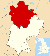
Map of Bedfordshire, UK with Bedford highlighted. Equirectangular map projection on WGS 84 datum, with N/S stretched 160% |
| 日付 | |
| 原典 |
|
| 作者 | Nilfanion, created using Ordnance Survey data |
| 許可 (ファイルの再利用) |
このファイルはクリエイティブ・コモンズ 表示-継承 3.0 非移植ライセンスのもとに利用を許諾されています。 帰属: Contains Ordnance Survey data © Crown copyright and database right
|
ファイルの履歴
過去の版のファイルを表示するには、その版の日時をクリックしてください。
| 日付と時刻 | サムネイル | 寸法 | 利用者 | コメント | |
|---|---|---|---|---|---|
| 現在の版 | 2011年8月3日 (水) 22:42 | | 1,120 × 1,266 (675キロバイト) | Nilfanion | {{Information |Description=Map of Bedfordshire, UK with Bedford highlighted. Equirectangular map projection on WGS 84 datum, with N/S stretched 160% |Source=Ordnance Survey [https://www.ord |
ファイルの使用状況
以下の 2 ページがこのファイルを使用しています:
グローバルなファイル使用状況
以下に挙げる他のウィキがこの画像を使っています:
- cy.wikipedia.org での使用状況
- da.wikipedia.org での使用状況
- en-two.iwiki.icu での使用状況
- es.wikipedia.org での使用状況
- fa.wikipedia.org での使用状況
- fi.wikipedia.org での使用状況
- frr.wikipedia.org での使用状況
- fr.wikipedia.org での使用状況
- Bedford (Royaume-Uni)
- Cardington (Bedfordshire)
- Kempston
- Wixams
- Bedford (district)
- Liste des paroisses civiles du Bedfordshire
- Carlton (Bedfordshire)
- Biddenham
- Modèle:Palette Bedford
- Oakley (Bedfordshire)
- Bletsoe
- Bolnhurst and Keysoe
- Colmworth
- Cople
- Wymington
- Staploe
- Stevington
- Stewartby
- Wootton (Bedfordshire)
- Willington (Bedfordshire)
- Wilden (Bedfordshire)
- Thurleigh
- Stagsden
- Sharnbrook
- Renhold
- Ravensden
- Podington
- Pertenhall
- Pavenham
- Odell (Bedfordshire)
- Milton Ernest
- Little Barford
- Little Staughton
- Harrold (Bedfordshire)
- Great Denham
- Great Barford
- Elstow
- Kempston Rural
- Knotting and Souldrop
- Dean and Shelton
- Wyboston, Chawston and Colesden
- Felmersham
- Chellington
このファイルのグローバル使用状況を表示する。