
ファイル:Covent Garden from the Ralph Agas 1572 map of London - marked.jpg
このプレビューのサイズ: 800 × 536 ピクセル。 その他の解像度: 320 × 214 ピクセル | 640 × 429 ピクセル | 821 × 550 ピクセル。
元のファイル (821 × 550 ピクセル、ファイルサイズ: 524キロバイト、MIME タイプ: image/jpeg)
ウィキメディア・コモンズのファイルページにある説明を、以下に表示します。
|
| 解説 |
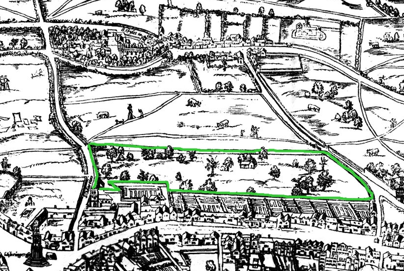
Small detail of the Ralph Agas London map of 1572. Modern marks in green of streets, and in yellow of Covent Garden wall. English: The earliest proper map (as opposed to panorama) of London known. Attributed to Ralph Agas, and probably surveyed between 1570 and 1605. The original was 6 foot 0.5 inches long by 2 feet 4.5 inches wide. This much reduced image is a scan of a copy of a lithograph of a copy, was itself badly repaired with sellotape and has had to be "restored"; so is hardly a truly faithful representation of the original, but few good copies exist and no other detailed public domain images are known. |
| 日付 | (UTC) |
| 原典 | |
| 作者 |
|
この画像には画像編集が施されています。原本に対して次のデジタル的な変更が行われました。
|
この著作物は、パブリックドメインの状態にある著作物を基にしています。これにはデジタル補正や加工が施されています。この二次的著作物は、その著作者である[[:c:User:{{{1}}}|{{{1}}}]]によってパブリックドメインとされています。これは全世界で適用されます。
一部の国では、これが法的に可能ではない場合があります。その場合、 |
元のアップロードログ
This image is a derivative work of the following images:
- File:Covent_Garden_from_the_Ralph_Agas_1572_map_of_London.jpg licensed with PD-self
- 2010-08-12T18:15:34Z SilkTork 821x550 (545301 Bytes) {{Information |Description=Small detail of the Ralph Agas London map of 1572. Modern marks in green of streets, and in yellow of Covent Garden wall. {{en|1=The earliest proper map (as opposed to panorama) of London known. A
Uploaded with derivativeFX
ファイルの履歴
過去の版のファイルを表示するには、その版の日時をクリックしてください。
| 日付と時刻 | サムネイル | 寸法 | 利用者 | コメント | |
|---|---|---|---|---|---|
| 現在の版 | 2010年8月23日 (月) 07:35 | | 821 × 550 (524キロバイト) | SilkTork | {{Information |Description=Small detail of the Ralph Agas London map of 1572. Modern marks in green of streets, and in yellow of Covent Garden wall. {{en|1=The earliest proper map (as opposed to panorama) of London known. Attributed to Ralph Agas, and p |
ファイルの使用状況
以下のページがこのファイルを使用しています:
グローバルなファイル使用状況
以下に挙げる他のウィキがこの画像を使っています:
- ar.wikipedia.org での使用状況
- azb.wikipedia.org での使用状況
- en-two.iwiki.icu での使用状況
- pt.wikipedia.org での使用状況
- ru.wikipedia.org での使用状況
- vi.wikipedia.org での使用状況
- zh-two.iwiki.icu での使用状況