
ファイル:EasternVirginia1775.jpg

このプレビューのサイズ: 757 × 599 ピクセル。 その他の解像度: 303 × 240 ピクセル | 606 × 480 ピクセル | 970 × 768 ピクセル | 1,280 × 1,013 ピクセル | 2,560 × 2,027 ピクセル | 3,360 × 2,660 ピクセル。
元のファイル (3,360 × 2,660 ピクセル、ファイルサイズ: 2.84メガバイト、MIME タイプ: image/jpeg)
ウィキメディア・コモンズのファイルページにある説明を、以下に表示します。
|
概要
| 解説 |
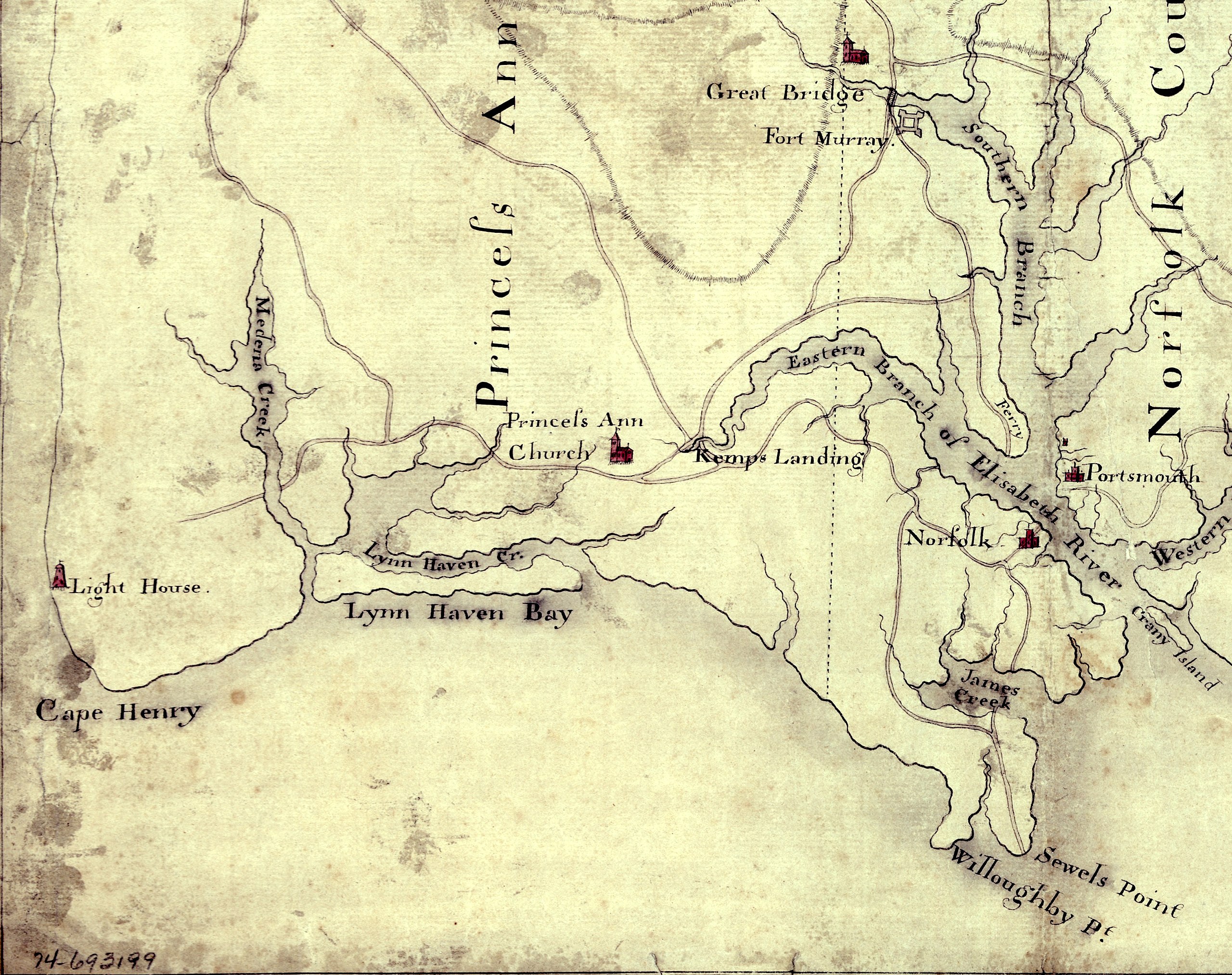
English: Detail of a 1780s manuscript map depicting the eastern coastal areas of Virginia, including portions of "Princess Anne" and Norfolk counties. The map is oriented with North to the bottom and South to the top. Part of the mouth of Chesapeake Bay is visible at the bottom of the map. The map depicts the sites of several military actions fought on land in the early days of the American Revolutionary War, including w:en:Battle of Kemp's Landing, w:en:Battle of Great Bridge, and the w:en:Burning of Norfolk, and the site of two sea battles of the war, the First and Second Battles of the Capes, the latter also known as w:en:Battle of the Chesapeake. |
||
| 日付 | 1785年頃 (Following a logistical and political delay of about 17 years, construction of the Cape Henry Lighthouse w:en:Cape Henry Light, depicted on the map, began about 1791 and was completed in 1792), LC claims "1779?;" Worldcat [1] claims "1785?". [See also "Early Map of First Colony’s Easternmost Landscape, Landmarks and Landowners"[2].]Hogident (トーク) 08:12, 26 January 2015 (UTC) | ||
| 原典 |
|
||
| 作者 | 不明 | ||
| 許可 (ファイルの再利用) |
[NP: Request a change in file name, since it contains a contradiction in the date(s) of the map.] |

ライセンス
|
この著作物は、著作権の保護期間が著作者の死後70年以下である国・地域においてパブリックドメインの状態にあります。
| |
| このファイルは著作権法の既知の制約(隣接権や関連する権利を含む)から自由であると特定されています。 | |
ファイルの履歴
過去の版のファイルを表示するには、その版の日時をクリックしてください。
| 日付と時刻 | サムネイル | 寸法 | 利用者 | コメント | |
|---|---|---|---|---|---|
| 現在の版 | 2010年8月5日 (木) 15:58 | | 3,360 × 2,660 (2.84メガバイト) | Magicpiano | {{Information |Description={{en|Detail of a 1770s manuscript map depicting the eastern coastal areas of Virginia, including portions of Princess Ann and Norfolk Counties. The map is oriented with North to the bottom and South to the top. Part of the |
ファイルの使用状況
以下の 2 ページがこのファイルを使用しています:
グローバルなファイル使用状況
以下に挙げる他のウィキがこの画像を使っています:
- ca.wikipedia.org での使用状況
- en-two.iwiki.icu での使用状況
- fi.wikipedia.org での使用状況
- fr.wikipedia.org での使用状況
- pt.wikipedia.org での使用状況
- ru.wikipedia.org での使用状況
- www.wikidata.org での使用状況