
ファイル:Galapagos-satellite-2002.jpg
このプレビューのサイズ: 800 × 600 ピクセル。 その他の解像度: 320 × 240 ピクセル | 640 × 480 ピクセル | 1,024 × 768 ピクセル | 1,280 × 960 ピクセル | 1,600 × 1,200 ピクセル。
元のファイル (1,600 × 1,200 ピクセル、ファイルサイズ: 387キロバイト、MIME タイプ: image/jpeg)
ウィキメディア・コモンズのファイルページにある説明を、以下に表示します。
|
概要
| 解説 |
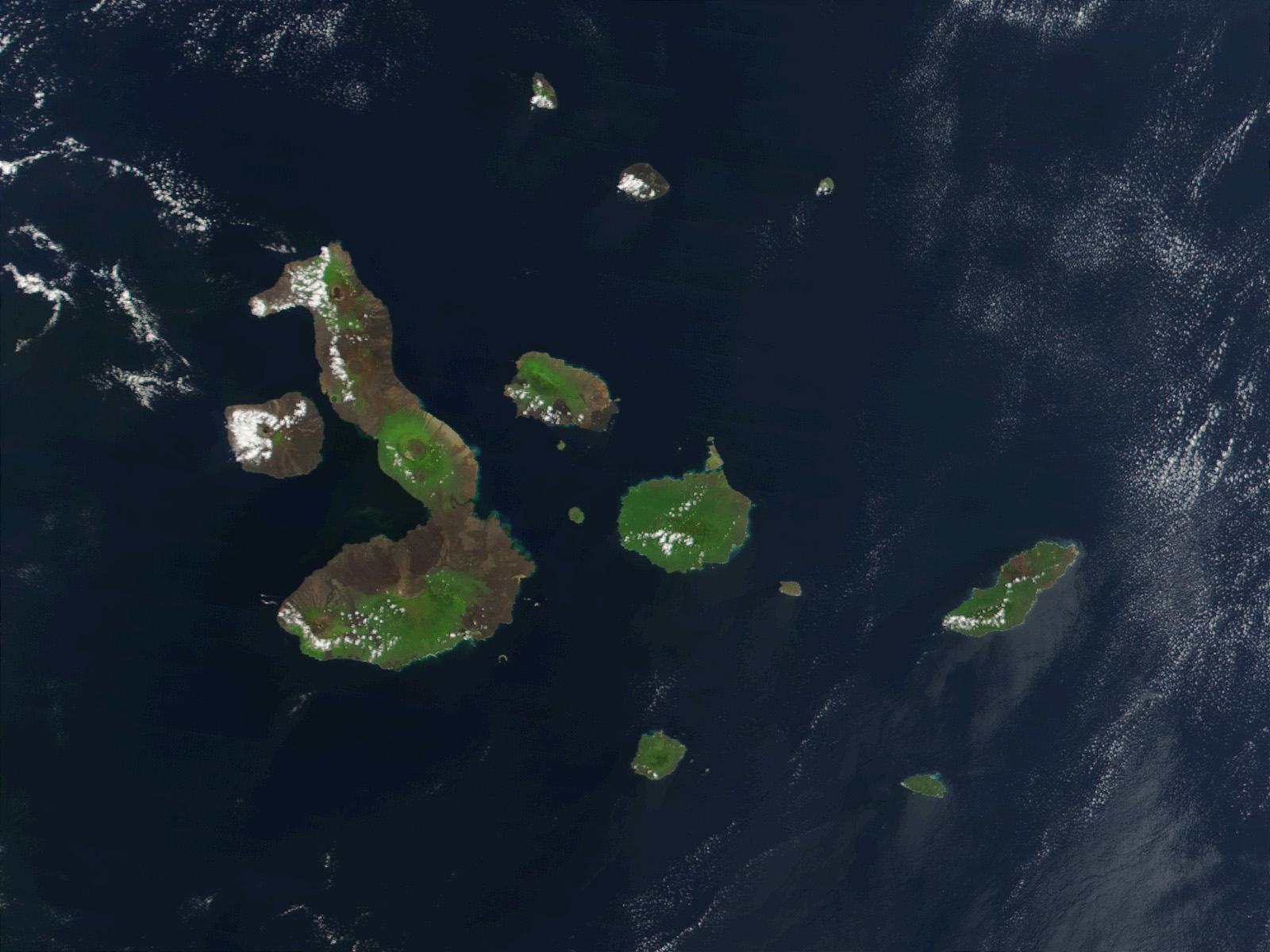
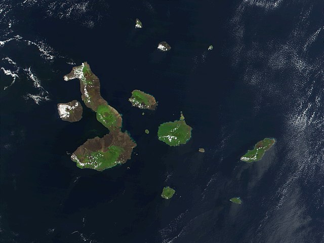
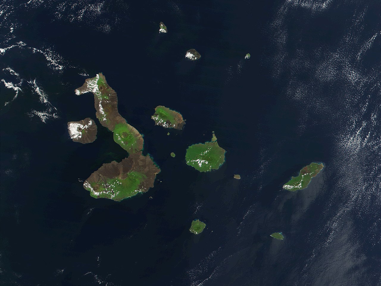
English: This true-color image of the Galapagos Islands was acquired on March 12, 2002, by the Moderate-resolution Imaging Spectroradiometer (MODIS), flying aboard NASA's Terra satellite. The Galapagos Islands, which are part of Ecuador, sit in the Pacific Ocean about 1000 km (620 miles) west of South America. As the three craters on the largest island (Isabela Island) suggest, the archipelago was created by volcanic eruptions, which took place millions of years ago. |
| 日付 | |
| 原典 | Earth Observatory 8270 and NASA GSFC |
| 作者 | Jacques Descloitres, MODIS Rapid Response Project at NASA/GSFC |
ライセンス
| このファイルはアメリカ航空宇宙局(NASA)によって作成されたものです。NASAの著作権の方針では、特記事項が無い場合、NASAの資料はパブリックドメインとなります。 (詳しくはTemplate:PD-USGov、NASAの著作権の方針について(英語)又はジェット推進研究所(JPL)の画像使用に関するガイドライン(英語)をご覧ください。) |
||
 |
注意事項:
|
| 注釈 | この画像には注釈がついています: コモンズで注釈を見る |
ファイルの履歴
過去の版のファイルを表示するには、その版の日時をクリックしてください。
| 日付と時刻 | サムネイル | 寸法 | 利用者 | コメント | |
|---|---|---|---|---|---|
| 現在の版 | 2007年11月25日 (日) 21:13 | | 1,600 × 1,200 (387キロバイト) | CarolSpears | {{Information |Description= This true-color image of the Galapagos Islands was acquired on March 12, 2002, by the Moderate-resolution Imaging Spectroradiometer (MODIS), flying aboard NASA's Terra satellite. The Galapagos Islands, which are part of Ecuador |
ファイルの使用状況
以下のページがこのファイルを使用しています:
グローバルなファイル使用状況
以下に挙げる他のウィキがこの画像を使っています:
- af.wikipedia.org での使用状況
- als.wikipedia.org での使用状況
- an.wikipedia.org での使用状況
- ast.wikipedia.org での使用状況
- azb.wikipedia.org での使用状況
- bg.wikipedia.org での使用状況
- bn.wikipedia.org での使用状況
- br.wikipedia.org での使用状況
- ca.wikipedia.org での使用状況
- cs.wikipedia.org での使用状況
- de.wikipedia.org での使用状況
- de.wikinews.org での使用状況
- en-two.iwiki.icu での使用状況
- en.wikivoyage.org での使用状況
- en.wiktionary.org での使用状況
- eo.wikipedia.org での使用状況
- es.wikipedia.org での使用状況
- frr.wikipedia.org での使用状況
- fr.wikipedia.org での使用状況
- hu.wikipedia.org での使用状況
- hy.wikipedia.org での使用状況
- incubator.wikimedia.org での使用状況
- it.wikipedia.org での使用状況
このファイルのグローバル使用状況を表示する。