
ファイル:Map for the Silesian and Seven Years Wars.jpg

このプレビューのサイズ: 800 × 592 ピクセル。 その他の解像度: 320 × 237 ピクセル | 640 × 474 ピクセル | 1,024 × 758 ピクセル | 1,280 × 948 ピクセル | 1,672 × 1,238 ピクセル。
元のファイル (1,672 × 1,238 ピクセル、ファイルサイズ: 438キロバイト、MIME タイプ: image/jpeg)
ウィキメディア・コモンズのファイルページにある説明を、以下に表示します。
|
概要
| 解説 |
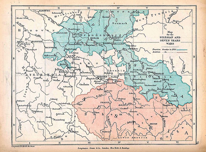
English: A map of Central Europe depicting the principal regions of conflict in the Silesian Wars of the 1740s–60s. The blue and red regions highlight Prussian and Austrian territory (respectively) as of 1756. |
| 日付 | |
| 原典 | The map is taken from "The Public Schools Historical Atlas" by Charles Colbeck. Longmans, Green, & Co.: New York; London; Bombay. 1905. It was accessed through the University of Texas at Austin's Perry-Castañeda Library Map Collection. The original map comes from "Frederick the Great and the Seven Years' War" by Frederick William Longman (1881). |
| 作者 |
Frederick William Longman Charles Colbeck (editor) |
ライセンス
|
著作者が1908年に死亡しているため、この著作物は、著作権の保護期間が著作者の死後100年以下である国・地域においてパブリックドメインの状態にあります。 この著作物は1929年1月1日以前に公表され、又はアメリカ合衆国著作権局に登録されたため、アメリカ合衆国においてパブリックドメインの状態にあります。 | |
| このファイルは著作権法の既知の制約(隣接権や関連する権利を含む)から自由であると特定されています。 | |
ファイルの履歴
過去の版のファイルを表示するには、その版の日時をクリックしてください。
| 日付と時刻 | サムネイル | 寸法 | 利用者 | コメント | |
|---|---|---|---|---|---|
| 現在の版 | 2019年10月7日 (月) 12:25 | | 1,672 × 1,238 (438キロバイト) | Soerfm | Contrast |
| 2019年1月7日 (月) 17:42 |  | 1,672 × 1,238 (338キロバイト) | Bryanrutherford0 | User created page with UploadWizard |
ファイルの使用状況
以下のページがこのファイルを使用しています:
グローバルなファイル使用状況
以下に挙げる他のウィキがこの画像を使っています:
- cs.wikipedia.org での使用状況
- en-two.iwiki.icu での使用状況
- Silesian Wars
- Second Silesian War
- Wikipedia:Featured topics
- First Silesian War
- Portal:Austria
- Third Silesian War
- Wikipedia:Featured and good topic candidates/Silesian Wars/archive1
- Wikipedia:Featured and good topic candidates/Featured log/June 2019
- Wikipedia:Featured and good topic candidates/Good log/June 2019
- Wikipedia:Featured topics/Silesian Wars
- Wikipedia:Today's featured article/requests/Silesian Wars
- es.wikipedia.org での使用状況
- fr.wikipedia.org での使用状況
- he.wikipedia.org での使用状況
- id.wikipedia.org での使用状況
- ka.wikipedia.org での使用状況
- pt.wikipedia.org での使用状況
- ru.wikipedia.org での使用状況
- sr.wikipedia.org での使用状況
- vi.wikipedia.org での使用状況
- zh-two.iwiki.icu での使用状況