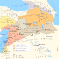
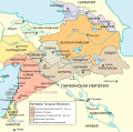
ファイル:Map of the Armenian Empire of Tigranes (English).svg
表示

この SVG ファイルのこの PNG プレビューのサイズ: 512 × 506 ピクセル. その他の解像度: 243 × 240 ピクセル | 486 × 480 ピクセル | 777 × 768 ピクセル | 1,036 × 1,024 ピクセル | 2,072 × 2,048 ピクセル。
元のファイル (SVG ファイル、512 × 506 ピクセル、ファイルサイズ: 61キロバイト)
ファイルの履歴
過去の版のファイルを表示するには、その版の日時をクリックしてください。
| 日付と時刻 | サムネイル | 寸法 | 利用者 | コメント | |
|---|---|---|---|---|---|
| 現在の版 | 2023年11月12日 (日) 14:31 |  | 512 × 506 (61キロバイト) | Artanisen | Uploaded a work by www.armenica.org . Original gif map made by Nareklm from Based on the maps: Maps of the Armenian Empire of Tigranes.gif and Maps of the Armenian Empire of Tigranes-fr.svg . Armenica.org . The source of the original map is: Robert H. Hewsen "Armenia: A Historical Atlas". The University of Chicago Press, 2001 ISBN 978-0-226-33228-4. Map 20 (The Empire of Tigran the Great, 95-66 BC), page 34. with UploadWizard |
ファイルの使用状況
グローバルなファイル使用状況
以下に挙げる他のウィキがこの画像を使っています:
- en-two.iwiki.icu での使用状況
- Ancient history
- Tigranes the Great
- Osroene
- Artsakh (historical province)
- Adiabene
- Kingdom of Armenia (antiquity)
- Republic of Artsakh
- Arzanene
- Taron (historic Armenia)
- Gardman
- Gugark
- Moxoene
- Ayrarat
- Armenian Kingdom of Cilicia
- Lesser Armenia
- Vaspurakan
- Tayk
- Sophene
- Gordyene
- Hemşin
- Bahçesaray, Van
- Paytakaran
- Template:Regions of Kingdom of Armenia
- Karin (historic Armenia)
- Commagene
- Satrapy of Armenia
- Armenian Mesopotamia
- Utik
- Upper Armenia
- United Armenia
- Kingdom of Tashir-Dzoraget
- Turuberan
- Mardistan
- Kingdom of Sophene
- Bagratid Armenia
- Kingdom of Artsakh
- Urartu
- Parthian war of Caracalla
- Dioceses of the Church of the East to 1318
- Provinces of the kingdom of Armenia (antiquity)
- Adiabene (East Syriac ecclesiastical province)
- Adarbaigan (East Syriac diocese)
- Nor Shirakan
- Kingdom of Vaspurakan
- Zakarid Armenia
- Classical Anatolia
- Melikdoms of Karabakh
- Tashir (historical region)
- Principality of Hamamshen
- Syunik (historical province)
このファイルのグローバル使用状況を表示する。


