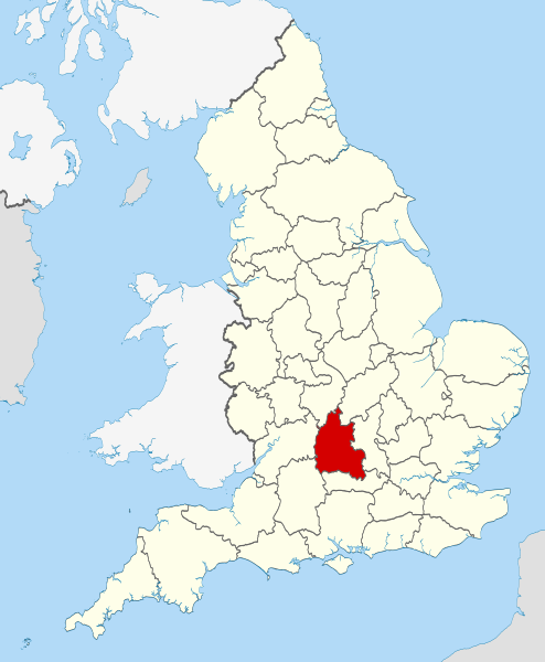
ファイル:Oxfordshire UK locator map 2010.svg
表示

この SVG ファイルのこの PNG プレビューのサイズ: 494 × 600 ピクセル. その他の解像度: 198 × 240 ピクセル | 395 × 480 ピクセル | 633 × 768 ピクセル | 843 × 1,024 ピクセル | 1,687 × 2,048 ピクセル | 1,108 × 1,345 ピクセル。
元のファイル (SVG ファイル、1,108 × 1,345 ピクセル、ファイルサイズ: 302キロバイト)
ファイルの履歴
過去の版のファイルを表示するには、その版の日時をクリックしてください。
| 日付と時刻 | サムネイル | 寸法 | 利用者 | コメント | |
|---|---|---|---|---|---|
| 現在の版 | 2010年11月23日 (火) 22:25 |  | 1,108 × 1,345 (302キロバイト) | Nilfanion | use ceremonial counties - corresponds with text of article better |
| 2010年11月23日 (火) 16:39 |  | 1,108 × 1,345 (332キロバイト) | Nilfanion | Fix coast - add Arran | |
| 2010年11月16日 (火) 00:47 |  | 1,108 × 1,345 (325キロバイト) | Nilfanion | thicker lines | |
| 2010年11月16日 (火) 00:44 |  | 1,108 × 1,345 (325キロバイト) | Nilfanion | {{Information |Description=Location of Oxfordshire within England, with the administrative counties shown. |Source=Ordnance Survey [https://www.ordnancesurvey.co.uk/opendatadownload/products.html OpenData]: *County |
ファイルの使用状況
以下の 3 ページがこのファイルを使用しています:
グローバルなファイル使用状況
以下に挙げる他のウィキがこの画像を使っています:
- af.wikipedia.org での使用状況
- an.wikipedia.org での使用状況
- ar.wikipedia.org での使用状況
- arz.wikipedia.org での使用状況
- ast.wikipedia.org での使用状況
- be-tarask.wikipedia.org での使用状況
- bg.wikipedia.org での使用状況
- bn.wikipedia.org での使用状況
- br.wikipedia.org での使用状況
- br.wiktionary.org での使用状況
- ca.wikipedia.org での使用状況
- ceb.wikipedia.org での使用状況
- cs.wikipedia.org での使用状況
- en-two.iwiki.icu での使用状況
- Oxfordshire
- Dragon Hill, Uffington
- RAF Bampton Castle
- Whitchurch-on-Thames
- Cowley Road, Oxford
- Redgrave Pinsent Rowing Lake
- Roke
- List of parliamentary constituencies in Oxfordshire
- Farmoor Reservoir
- Mill Meadows, Henley-on-Thames
- River Evenlode
- Radford, Oxfordshire
- Angel & Greyhound Meadow, Oxford
- Curbridge, Oxfordshire
- Risinghurst and Sandhills
- Barford St. John and St. Michael
- Template:Oxfordshire-geo-stub
- Ardington
- Aston, Cote, Shifford and Chimney
- Aston Upthorpe
- Beckley and Stowood
- Bix and Assendon
- Blenheim, Oxfordshire
- Peckwater Quadrangle
- Bourton, Cherwell
- Bruern
- Ploughley Rural District
- Hanney
- Waterperry
- Dunsden Green
- Milton-under-Wychwood
- North Newington
- The Trout Inn
このファイルのグローバル使用状況を表示する。


