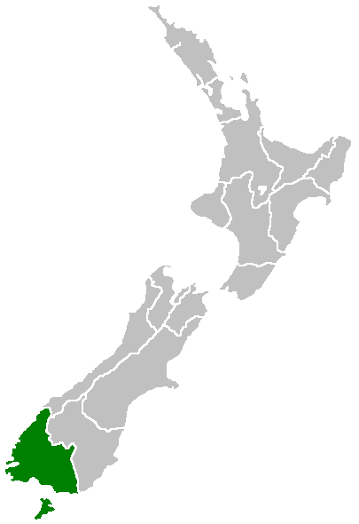
ファイル:Position of Southland Region.png
表示
Position_of_Southland_Region.png (405 × 590 ピクセル、ファイルサイズ: 7キロバイト、MIME タイプ: image/png)
ファイルの履歴
過去の版のファイルを表示するには、その版の日時をクリックしてください。
| 日付と時刻 | サムネイル | 寸法 | 利用者 | コメント | |
|---|---|---|---|---|---|
| 現在の版 | 2005年4月27日 (水) 07:41 |  | 405 × 590 (7キロバイト) | Domie~commonswiki | Region of New Zealand, position on the map (source:English Wiki) {{PD}} Category:Maps of New Zealand |
ファイルの使用状況
以下のページがこのファイルを使用しています:
グローバルなファイル使用状況
以下に挙げる他のウィキがこの画像を使っています:
- en-two.iwiki.icu での使用状況
- Pearl Harbour, New Zealand
- Halfmoon Bay (Stewart Island)
- Mavora Lakes
- Mount Anglem
- Te Waewae Bay
- Toetoes Bay
- Oreti Beach
- South Cape / Whiore
- Anchorage Island (New Zealand)
- Gore Aerodrome
- Waipapa Point
- Mount Pye (New Zealand)
- Porpoise Bay (New Zealand)
- Drummond, New Zealand
- Template:Southland-geo-stub
- Browns, New Zealand
- Springhills
- Rakahouka
- Longbush, Southland
- Roslyn Bush
- Glencoe, New Zealand
- Waitane
- Te Tipua
- Birchwood, New Zealand
- Murihiku
- Anderson Park, Invercargill
- Great South Basin
- Waimatuku
- Pukewao
- Te Peka
- Fortification, New Zealand
- Titiroa
- Pine Bush, New Zealand
- Kapuka South
- Oteramika
- Timpanys
- Waikawa, Southland
- White Hill Wind Farm
- Lorneville, New Zealand
- Rakatu Wetlands
- Kepler Mire
- Mount Allen (Stewart Island)
- Wallace County, New Zealand
- Big Bay (New Zealand)
- Clifden Limestone Caves
- Raratoka Island
- Longwood Range
- Waimea Plain (Southland)
- Waituna Lagoon
- Lake Henry (New Zealand)
このファイルのグローバル使用状況を表示する。

