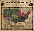
ファイル:Reynolds's Political Map of the United States 1856.jpg
表示

このプレビューのサイズ: 661 × 600 ピクセル。 その他の解像度: 265 × 240 ピクセル | 529 × 480 ピクセル | 846 × 768 ピクセル | 1,128 × 1,024 ピクセル | 2,257 × 2,048 ピクセル | 7,813 × 7,090 ピクセル。
元のファイル (7,813 × 7,090 ピクセル、ファイルサイズ: 19.76メガバイト、MIME タイプ: image/jpeg)
ファイルの履歴
過去の版のファイルを表示するには、その版の日時をクリックしてください。
| 日付と時刻 | サムネイル | 寸法 | 利用者 | コメント | |
|---|---|---|---|---|---|
| 現在の版 | 2023年8月16日 (水) 18:29 |  | 7,813 × 7,090 (19.76メガバイト) | Jengod | Autotune so brighter and easier to read |
| 2016年4月22日 (金) 07:28 |  | 7,813 × 7,090 (35.27メガバイト) | Khamar | Original improved in Adobe Photoshop by removing white strip through center where left and right sides of map join, removing some dark and white stripes from image, and nudging some of the text and lines back into alignment preserving as much of the ma... | |
| 2012年12月17日 (月) 01:40 |  | 7,828 × 7,090 (16.56メガバイト) | T3hBra1nWa5her | Higher resolution version from the [http://memory.loc.gov/cgi-bin/query/h?ammem/gmd:@field(NUMBER+@band(g3701e+ct000604)) Library of Congress Geography and Map Division Washington]. | |
| 2008年8月1日 (金) 13:15 |  | 2,000 × 1,736 (709キロバイト) | Bdamokos | {{Information |Description={{en|US map 1856 shows free and slave states and populations; this is "Reynolds's Political Map of the United States" (1856) from Library of Congress collection[http://lcweb2.loc.gov/ammem/aaohtml/exhibit/aopart3b.html] [[:en |
ファイルの使用状況
以下の 2 ページがこのファイルを使用しています:
グローバルなファイル使用状況
以下に挙げる他のウィキがこの画像を使っています:
- ar.wikipedia.org での使用状況
- ca.wikipedia.org での使用状況
- de.wikipedia.org での使用状況
- en-two.iwiki.icu での使用状況
- en.wikiquote.org での使用状況
- es.wikipedia.org での使用状況
- fa.wikipedia.org での使用状況
- fi.wikipedia.org での使用状況
- fr.wikipedia.org での使用状況
- he.wikipedia.org での使用状況
- hu.wikipedia.org での使用状況
- id.wikipedia.org での使用状況
- it.wikipedia.org での使用状況
- ko.wikipedia.org での使用状況
- no.wikipedia.org での使用状況
- pl.wikipedia.org での使用状況
- pt.wikipedia.org での使用状況
- ro.wikipedia.org での使用状況
- ru.wikipedia.org での使用状況
- sh.wikipedia.org での使用状況
- simple.wikipedia.org での使用状況
このファイルのグローバル使用状況を表示する。
