
ファイル:Shropshire UK location map.svg

この SVG ファイルのこの PNG プレビューのサイズ: 550 × 599 ピクセル. その他の解像度: 220 × 240 ピクセル | 441 × 480 ピクセル | 705 × 768 ピクセル | 940 × 1,024 ピクセル | 1,880 × 2,048 ピクセル | 1,198 × 1,305 ピクセル。
元のファイル (SVG ファイル、1,198 × 1,305 ピクセル、ファイルサイズ: 2.13メガバイト)
ウィキメディア・コモンズのファイルページにある説明を、以下に表示します。
|
| 解説 |
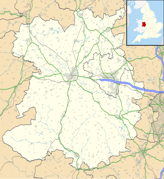
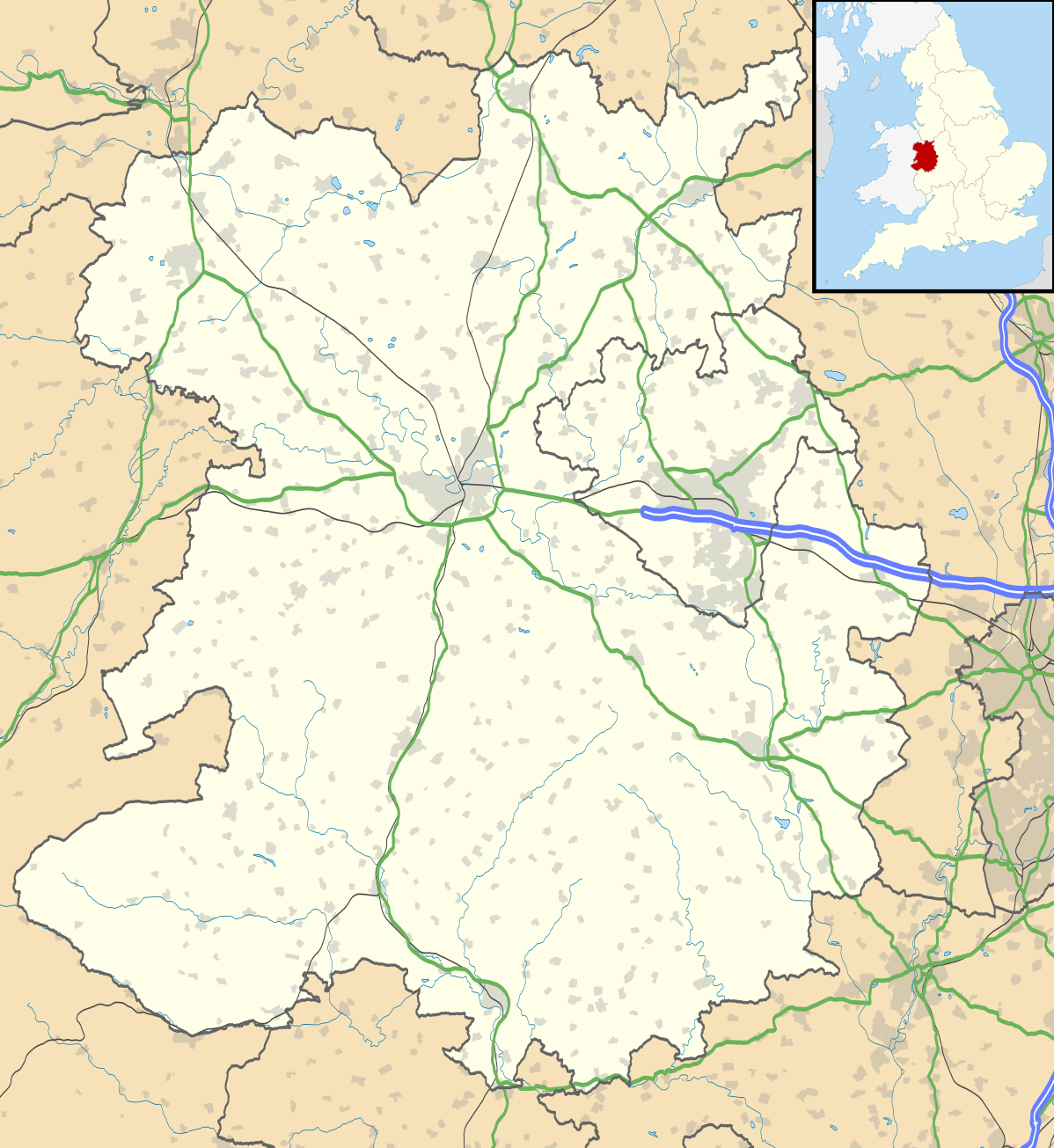
Map of Shropshire, UK with the following information shown:
Equirectangular map projection on WGS 84 datum, with N/S stretched 165% Geographic limits:
|
| 日付 | |
| 原典 |
|
| 作者 | Nilfanion, created using Ordnance Survey data |
| 許可 (ファイルの再利用) |
このファイルはクリエイティブ・コモンズ 表示-継承 3.0 非移植ライセンスのもとに利用を許諾されています。 帰属: Contains Ordnance Survey data © Crown copyright and database right
|
| その他のバージョン | File:Shropshire UK district map (blank).svg - Blank map |
.svg)
ファイルの履歴
過去の版のファイルを表示するには、その版の日時をクリックしてください。
| 日付と時刻 | サムネイル | 寸法 | 利用者 | コメント | |
|---|---|---|---|---|---|
| 現在の版 | 2010年10月16日 (土) 19:51 | | 1,198 × 1,305 (2.13メガバイト) | Nilfanion | fix to A442 |
| 2010年9月26日 (日) 19:11 |  | 1,198 × 1,305 (2.12メガバイト) | Nilfanion | {{Information |Description=Map of Shropshire, UK with the following information shown: *Administrative borders *Coastline, lakes and rivers *Roads and railways *Urban areas Equirectangular map projection on WGS 84 datum, with N/S stretch |
ファイルの使用状況
以下の 6 ページがこのファイルを使用しています:
グローバルなファイル使用状況
以下に挙げる他のウィキがこの画像を使っています:
- ar.wikipedia.org での使用状況
- azb.wikipedia.org での使用状況
- bg.wikipedia.org での使用状況
- ceb.wikipedia.org での使用状況
- cy.wikipedia.org での使用状況
- en-two.iwiki.icu での使用状況
- Ludlow
- Ironbridge
- Stokesay Castle
- Telford
- Ludlow Castle
- Church Stretton
- Newport, Shropshire
- Oswestry
- Old Oswestry
- Whitchurch, Shropshire
- Market Drayton
- Bishop's Castle
- Bridgnorth
- Ellesmere, Shropshire
- Alveley
- Baschurch
- Woore
- Ruyton-XI-Towns
- Viroconium Cornoviorum
- Sheriffhales
- Weston Lullingfields
- Wroxeter
- Hampton Loade
- Clun
- Coalbrookdale
- Atcham
- Clun Castle
- Shawbury
- Shrewsbury Castle
- Attingham Park
- Wellington, Shropshire
- Oakengates
- Donnington, Telford
- Wem
- RAF Shawbury
- Much Wenlock
- Hopton Heath
- Sundorne
- Harlescott
- Ditherington
- Nesscliffe
- Cleobury Mortimer
- Hay Inclined Plane
- Snailbeach
- Pontesbury
このファイルのグローバル使用状況を表示する。