
ファイル:Stony Point State Park.jpg
元のファイル (3,591 × 2,539 ピクセル、ファイルサイズ: 3.16メガバイト、MIME タイプ: image/jpeg)
ウィキメディア・コモンズのファイルページにある説明を、以下に表示します。
|
| 解説 |
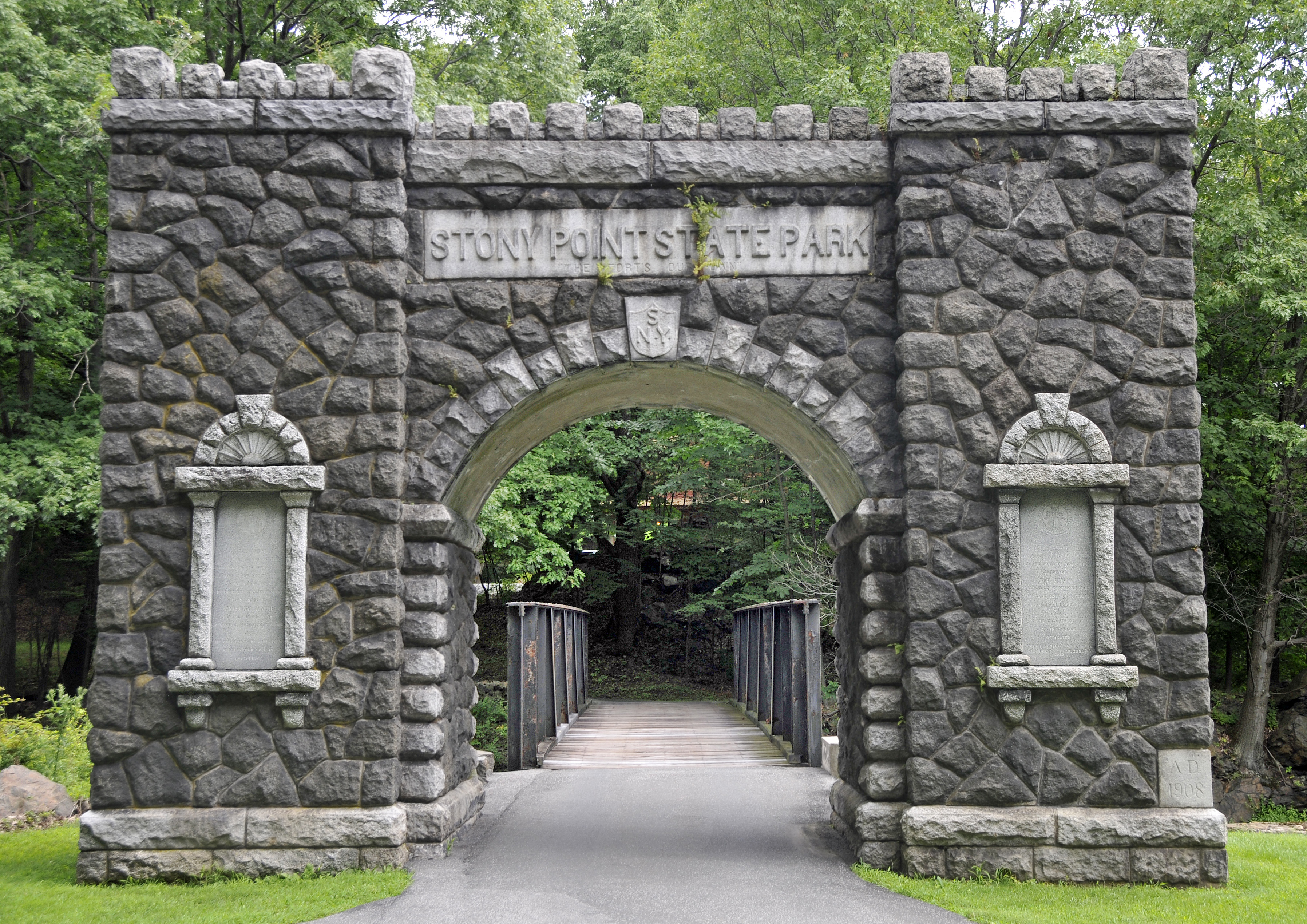
Visit the site of the Battle of Stony Point, one of the last major Revolutionary War battles in the northeastern colonies. This is where Brigadier General Anthony Wayne led his corps of Continental Light Infantry in a daring midnight attack on the British, seizing the site's fortifications and taking the British garrison as prisoners on July 16, 1779. By the late 1770s, the war had been raging for four years and both sides were eager for a conclusion. Sir Henry Clinton, commander of the British forces in America, attempted to coerce General George Washington into one decisive battle to control the Hudson River. As part of his strategy, Clinton fortified Stony Point. Washington devised a plan for Wayne to lead an attack on the fort. Armed with bayonets only, the infantry captured the fort in short order, ending British control of the river. The site features a museum, which offers exhibits on the battle and the 1826 Stony Point Lighthouse, as well as interpretive programs, such as reenactments highlighting 18th century military life, cannon and musket firings, cooking demonstrations, and children's activities. source: State of New York |
||
| 日付 | |||
| 原典 | originally posted to Flickr as Entrance to Stony Point State Park | ||
| 作者 | Tony | ||
| 許可 (ファイルの再利用) |
このファイルはクリエイティブ・コモンズ 表示 2.0 一般ライセンスのもとに利用を許諾されています。
|
| 被写体の位置 | | 以下のサービスでこの位置を確認する: オープンストリートマップ |
|---|
ファイルの履歴
過去の版のファイルを表示するには、その版の日時をクリックしてください。
| 日付と時刻 | サムネイル | 寸法 | 利用者 | コメント | |
|---|---|---|---|---|---|
| 現在の版 | 2008年9月3日 (水) 00:36 | | 3,591 × 2,539 (3.16メガバイト) | Flickr upload bot | Uploaded from http://flickr.com/photo/22714323@N06/2754499034 using Flickr upload bot |
ファイルの使用状況
以下のページがこのファイルを使用しています:
グローバルなファイル使用状況
以下に挙げる他のウィキがこの画像を使っています:
- ceb.wikipedia.org での使用状況
- de.wikipedia.org での使用状況
- en-two.iwiki.icu での使用状況
- en.wikivoyage.org での使用状況
- es.wikipedia.org での使用状況
- fr.wikipedia.org での使用状況
- pt.wikipedia.org での使用状況
- www.wikidata.org での使用状況
- zh-two.iwiki.icu での使用状況