
ファイル:Thistle landslide.png

このプレビューのサイズ: 780 × 600 ピクセル。 その他の解像度: 312 × 240 ピクセル | 624 × 480 ピクセル | 999 × 768 ピクセル | 1,280 × 985 ピクセル | 2,600 × 2,000 ピクセル。
元のファイル (2,600 × 2,000 ピクセル、ファイルサイズ: 794キロバイト、MIME タイプ: image/png)
ウィキメディア・コモンズのファイルページにある説明を、以下に表示します。
|
概要
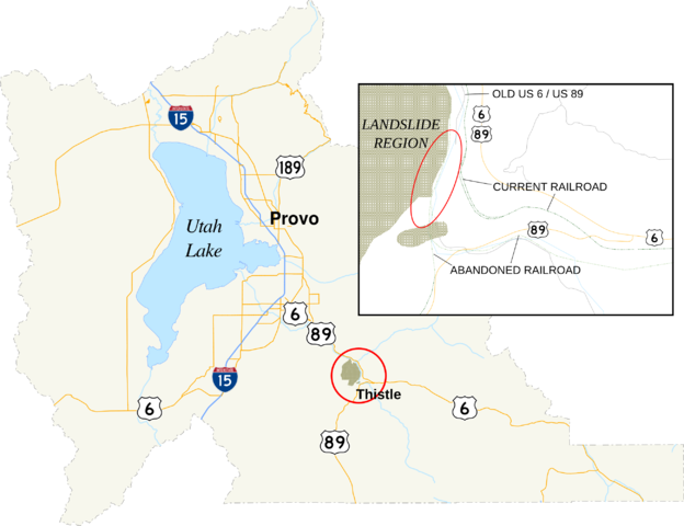
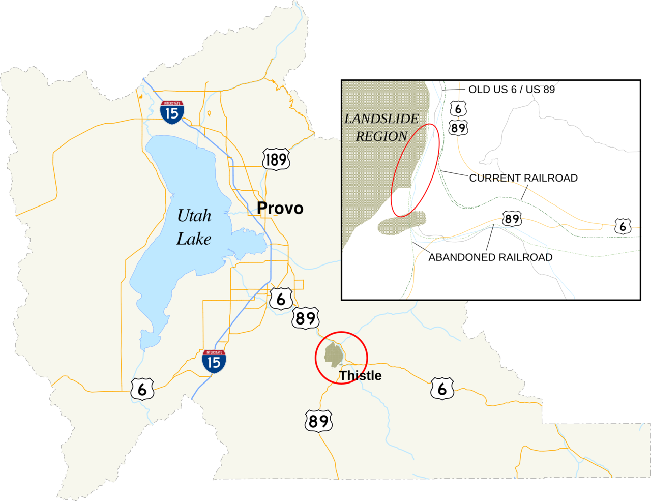
| 解説 | A map of Utah County, Utah, showing the location of Thistle in the county. In the map is an inset of the region affected by the 1983 landslide. The red circle denotes the area enlarged in the inset. The red oval is the approximate location of the landslide dam. |
| 日付 | |
| 原典 |
Utah State Geographic Information Database |
| 作者 | Fredddie. Created using Quantum GIS and inkscape, per standards set by the English language wikipedia's U.S. Roads Map Task Force. |
ライセンス
この作品は、次の理由でパブリックドメインに属します。data provided by Utah State Geographic Information Database is considered to be in the public domain.[1]
パブリックドメインの適用が法的に不可能な場合: 誰でも、いかなる目的であっても、法令によって要求される条件以外のいかなる条件も課されることなしに、この作品を利用する権利が認められます。 上記で説明されている理由が、コモンズのライセンス方針に準拠しているかどうか検証してください。
|
ファイルの履歴
過去の版のファイルを表示するには、その版の日時をクリックしてください。
| 日付と時刻 | サムネイル | 寸法 | 利用者 | コメント | |
|---|---|---|---|---|---|
| 現在の版 | 2010年8月18日 (水) 05:25 | | 2,600 × 2,000 (794キロバイト) | Fredddie | {{Information |Description=A map of Utah County, Utah, showing the location of Thistle in the county. In the map is an inset of the region affected by the 1983 landslide. |Source={{own}} |Date=2010-08-18 |Author=Fredddie |Permission= |o |
ファイルの使用状況
以下のページがこのファイルを使用しています:
グローバルなファイル使用状況
以下に挙げる他のウィキがこの画像を使っています:
- en-two.iwiki.icu での使用状況
- sco.wikipedia.org での使用状況