
ファイル:USACE John H Kerr Dam and Lake.jpg
このプレビューのサイズ: 800 × 533 ピクセル。 その他の解像度: 320 × 213 ピクセル | 640 × 427 ピクセル | 1,024 × 683 ピクセル | 1,500 × 1,000 ピクセル。
元のファイル (1,500 × 1,000 ピクセル、ファイルサイズ: 651キロバイト、MIME タイプ: image/jpeg)
ウィキメディア・コモンズのファイルページにある説明を、以下に表示します。
|
| 解説 |
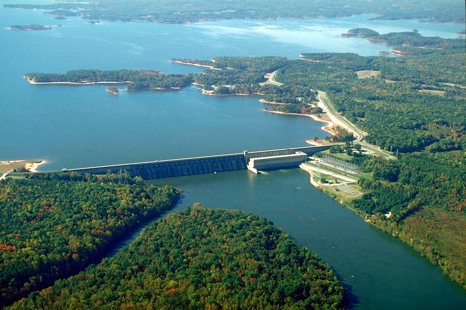
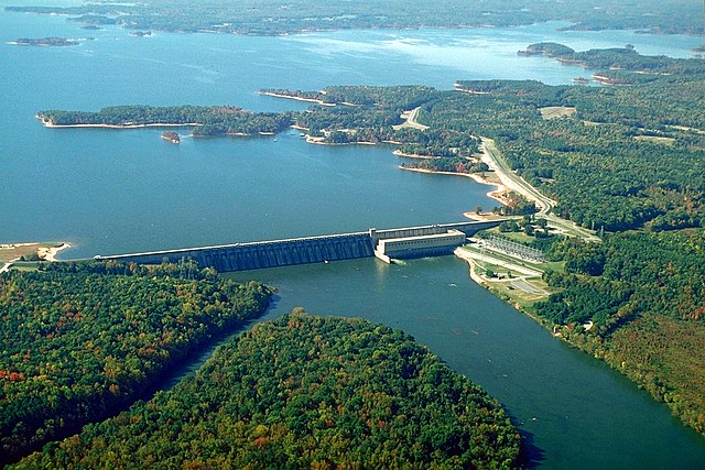
English: The John H. Kerr Dam and Lake on the Roanoke River in Mecklenburg County, Virginia, USA. The U.S. Army Corps of Engineers constructed the dam for flood control on the Roanoke River. View is to the south-southwest.
Coordinates: 36°35′53.76″N 78°17′53.63″W / 36.5982667°N 78.2982306°W |
|||
| 場所 | Mecklenburg County, Virginia, USA | |||
| 日付 | (Caveat: Dates provided by U.S. Army Corps of Engineers Digital Visual Library are not reliable and are often wrong.) | |||
| 原典 |
U.S. Army Corps of Engineers Digital Visual Library Image page Image description page Digital Visual Library home page |
|||
| 作者 | Bud Davis, U.S. Army Corps of Engineers | |||
| 許可 (ファイルの再利用) |
|
ファイルの履歴
過去の版のファイルを表示するには、その版の日時をクリックしてください。
| 日付と時刻 | サムネイル | 寸法 | 利用者 | コメント | |
|---|---|---|---|---|---|
| 現在の版 | 2007年4月26日 (木) 04:40 | | 1,500 × 1,000 (651キロバイト) | DanMS | {{Information | Description = {{en|The John H. Kerr Dam and Lake on the Roanoke River in Mecklenburg County, Virginia, USA. The U.S. Army Corps of Engineers constructed the dam for flood control on the Roanoke River. View is to the south-southwest.}} C |
ファイルの使用状況
以下のページがこのファイルを使用しています:
グローバルなファイル使用状況
以下に挙げる他のウィキがこの画像を使っています:
- ceb.wikipedia.org での使用状況
- de.wikipedia.org での使用状況
- en-two.iwiki.icu での使用状況
- es.wikipedia.org での使用状況
- fr.wikipedia.org での使用状況
- no.wikipedia.org での使用状況
- sr.wikipedia.org での使用状況
- uk.wikipedia.org での使用状況
- www.wikidata.org での使用状況