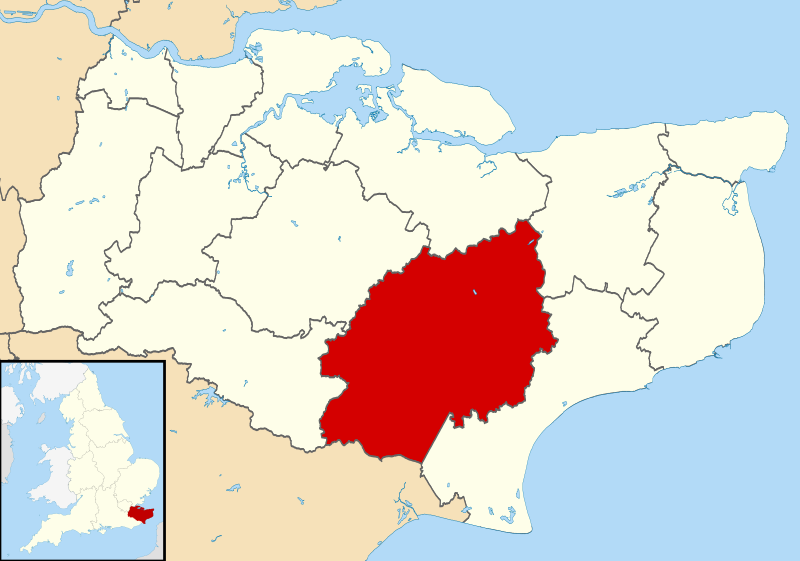
ファイル:Ashford UK locator map.svg
表示

この SVG ファイルのこの PNG プレビューのサイズ: 800 × 561 ピクセル. その他の解像度: 320 × 225 ピクセル | 640 × 449 ピクセル | 1,024 × 719 ピクセル | 1,280 × 898 ピクセル | 2,560 × 1,796 ピクセル | 1,425 × 1,000 ピクセル。
元のファイル (SVG ファイル、1,425 × 1,000 ピクセル、ファイルサイズ: 1.18メガバイト)
ファイルの履歴
過去の版のファイルを表示するには、その版の日時をクリックしてください。
| 日付と時刻 | サムネイル | 寸法 | 利用者 | コメント | |
|---|---|---|---|---|---|
| 現在の版 | 2011年8月2日 (火) 09:05 |  | 1,425 × 1,000 (1.18メガバイト) | Nilfanion | {{Information |Description=Map of Kent, UK with Ashford highlighted. Equirectangular map projection on WGS 84 datum, with N/S stretched 160% |Source=Ordnance Survey [https://www.ordnancesurvey.co.u |
ファイルの使用状況
以下の 2 ページがこのファイルを使用しています:
グローバルなファイル使用状況
以下に挙げる他のウィキがこの画像を使っています:
- cy.wikipedia.org での使用状況
- en-two.iwiki.icu での使用状況
- es.wikipedia.org での使用状況
- fi.wikipedia.org での使用状況
- fr.wikipedia.org での使用状況
- Ashford
- Egerton (Kent)
- Appledore (Kent)
- Godmersham
- Aldington Frith
- Ashford (borough)
- Ebony (Kent)
- Eastwell
- Small Hythe
- Rolvenden Layne
- Leigh Green
- Bromley Green
- Kingsnorth
- Brook (Kent)
- Modèle:Palette Borough d'Ashford
- Hamstreet
- Brabourne Lees
- Smeeth
- Liste des paroisses civiles du Kent
- Bethersden
- Aldington (Kent)
- Anvil Green
- Bilsington
- Bilting
- Bonnington
- Boughton Aluph
- Boughton Lees
- Brabourne
- Brattle
- Challock
- Charing
- Chilham
- Chilmington Green
- Crundale (Kent)
- Great Chart
- Hastingleigh
- High Halden
- Hothfield
- Kenardington
- Kennington (Kent)
- Little Chart
- Mersham
- Molash
- Newenden
- Orlestone
- Pluckley
このファイルのグローバル使用状況を表示する。
