
ファイル:Cotton-map-transcript.png
このプレビューのサイズ: 508 × 599 ピクセル。 その他の解像度: 203 × 240 ピクセル | 407 × 480 ピクセル | 819 × 966 ピクセル。
元のファイル (819 × 966 ピクセル、ファイルサイズ: 284キロバイト、MIME タイプ: image/png)
ウィキメディア・コモンズのファイルページにある説明を、以下に表示します。
|
概要
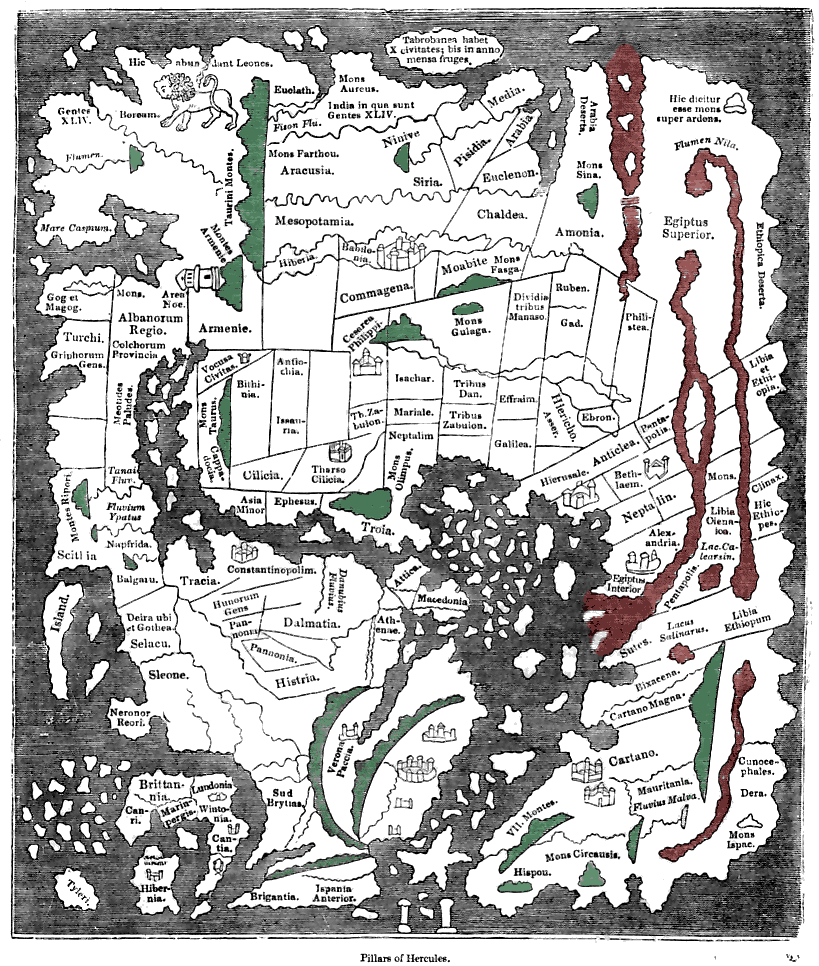
| 解説 | Tracing of the 'Cotton' Anglo-Saxon world map (British Library; Cotton MSS, Tib. B. V, folio 56.; date probably about AD 1000) as published ca. 1836 with printed place-names. Ceylon ("Taprobanea") is at top, Britain at lower left. Green and red colours have been added by me to indicate similarly coloured areas (representing mountains and the waters of Africa respectively) on the original map. Please note that accuracy of the tracing and caption transcripts is not guaranteed. |
| 日付 | (transcript c1836) |
| 原典 | Knight, Charles (comp.) "Old England: A Pictorial Museum", London, Sangster (c1836) |
| 作者 | Unknown (medieval), redrawn ca. 1836 |
ライセンス
|
この著作物は、著作権の保護期間が著作者の死後70年以下である国・地域においてパブリックドメインの状態にあります。 | |
| このファイルは著作権法の既知の制約(隣接権や関連する権利を含む)から自由であると特定されています。 | |
ファイルの履歴
過去の版のファイルを表示するには、その版の日時をクリックしてください。
| 日付と時刻 | サムネイル | 寸法 | 利用者 | コメント | |
|---|---|---|---|---|---|
| 現在の版 | 2008年2月4日 (月) 21:03 | | 819 × 966 (284キロバイト) | David Trochos | {{Information |Description= Tracing of the 'Cotton' Anglo-Saxon world map (British Library; Cotton MSS, Tib. B. V, folio 56.; date probably about AD 1000) with printed place-names. Green and red colours have been added by me to indicate similarly coloured |
ファイルの使用状況
以下のページがこのファイルを使用しています:
グローバルなファイル使用状況
以下に挙げる他のウィキがこの画像を使っています:
- de.wikipedia.org での使用状況
- pt.wikipedia.org での使用状況
- uk.wikipedia.org での使用状況