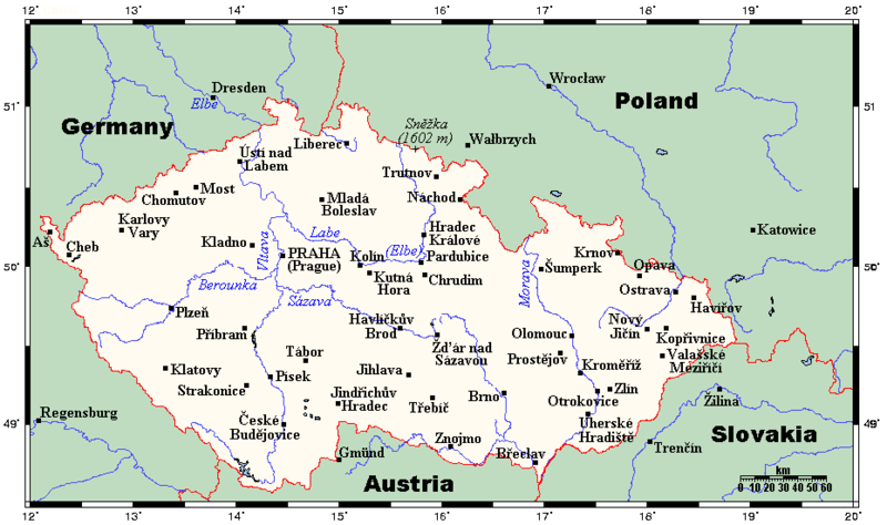
ファイル:CzechRepCitiesTowns.png
表示

このプレビューのサイズ: 800 × 474 ピクセル。 その他の解像度: 320 × 190 ピクセル | 640 × 379 ピクセル | 930 × 551 ピクセル。
元のファイル (930 × 551 ピクセル、ファイルサイズ: 35キロバイト、MIME タイプ: image/png)
ファイルの履歴
過去の版のファイルを表示するには、その版の日時をクリックしてください。
| 日付と時刻 | サムネイル | 寸法 | 利用者 | コメント | |
|---|---|---|---|---|---|
| 現在の版 | 2012年2月10日 (金) 17:21 |  | 930 × 551 (35キロバイト) | Miaow Miaow | added city of Opava |
| 2012年2月10日 (金) 16:15 |  | 930 × 551 (32キロバイト) | Miaow Miaow | removed Líšeň (presumably a tongue-in-cheek addition by the original creator ?), which is merely a suburb of Brno and of much less importance than other cities depicted | |
| 2009年3月25日 (水) 15:57 |  | 930 × 551 (31キロバイト) | Georgez | {{Information |Description={{en|A map showing the Czech Republic's main cities and towns, and nearby areas in neighbouring countries. This map's source is [http://www.aquarius.ifm-geomar.de/ here], with the uploader's modifications, and the [http://gmt.so |
ファイルの使用状況
以下のページがこのファイルを使用しています:
グローバルなファイル使用状況
以下に挙げる他のウィキがこの画像を使っています:
- ar.wikipedia.org での使用状況
- bs.wikipedia.org での使用状況
- el.wikipedia.org での使用状況
- en-two.iwiki.icu での使用状況
- lt.wikipedia.org での使用状況
- mk.wikipedia.org での使用状況
- pt.wikipedia.org での使用状況

