
ファイル:Kvarner gulf map.png
Kvarner_gulf_map.png (401 × 584 ピクセル、ファイルサイズ: 208キロバイト、MIME タイプ: image/png)
ウィキメディア・コモンズのファイルページにある説明を、以下に表示します。
|
| 解説 |
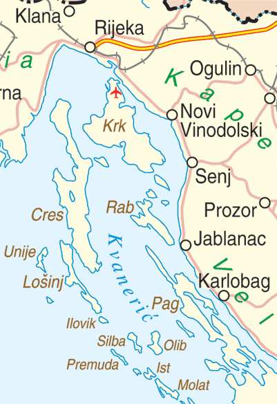
English: Map of the Kvarner Gulf, Croatia |
|||
| 日付 | ||||
| 原典 | http://www.un.org/Depts/Cartographic/map/profile/croatia.pdf | |||
| 作者 | Department of Peacekeeping Operations Cartographic Section | |||
| 許可 (ファイルの再利用) |
|

ファイルの履歴
過去の版のファイルを表示するには、その版の日時をクリックしてください。
| 日付と時刻 | サムネイル | 寸法 | 利用者 | コメント | |
|---|---|---|---|---|---|
| 現在の版 | 2016年2月13日 (土) 22:04 | | 401 × 584 (208キロバイト) | Hrbackpacker | again. (sorry I am new) :) |
| 2016年2月13日 (土) 22:02 |  | 401 × 584 (210キロバイト) | Hrbackpacker | made mistake with upload, here is new file with correct airport location | |
| 2016年2月13日 (土) 22:01 |  | 401 × 584 (47キロバイト) | Hrbackpacker | Fixed location of Rijeka airport | |
| 2005年9月30日 (金) 20:07 |  | 401 × 584 (47キロバイト) | MRB | Map of the Kvarner Gulf, Croatia Extracted from http://www.un.org/Depts/Cartographic/map/profile/croatia.pdf {{PD}} |
ファイルの使用状況
以下のページがこのファイルを使用しています:
グローバルなファイル使用状況
以下に挙げる他のウィキがこの画像を使っています:
- ar.wikipedia.org での使用状況
- bg.wikipedia.org での使用状況
- cs.wikipedia.org での使用状況
- da.wikipedia.org での使用状況
- de.wikipedia.org での使用状況
- el.wikipedia.org での使用状況
- en-two.iwiki.icu での使用状況
- en.wikivoyage.org での使用状況
- eo.wikipedia.org での使用状況
- es.wikipedia.org での使用状況
- et.wikipedia.org での使用状況
- fa.wikipedia.org での使用状況
- fi.wikipedia.org での使用状況
- fr.wikipedia.org での使用状況
- fr.wikivoyage.org での使用状況
- he.wikipedia.org での使用状況
- hr.wikipedia.org での使用状況
- hu.wikipedia.org での使用状況
- hyw.wikipedia.org での使用状況
- it.wikipedia.org での使用状況
- ka.wikipedia.org での使用状況
- ko.wikipedia.org での使用状況
- la.wikipedia.org での使用状況
- lt.wikipedia.org での使用状況
- mk.wikipedia.org での使用状況
- nl.wikipedia.org での使用状況
- nn.wikipedia.org での使用状況
- no.wikipedia.org での使用状況
- pl.wikipedia.org での使用状況
- ru.wikipedia.org での使用状況
- sk.wikipedia.org での使用状況
- sl.wikipedia.org での使用状況
- sr.wikipedia.org での使用状況
- sv.wikipedia.org での使用状況
- uk.wikipedia.org での使用状況
このファイルのグローバル使用状況を表示する。