
ファイル:Outer Hebrides UK location map.svg

この SVG ファイルのこの PNG プレビューのサイズ: 456 × 600 ピクセル. その他の解像度: 182 × 240 ピクセル | 365 × 480 ピクセル | 584 × 768 ピクセル | 779 × 1,024 ピクセル | 1,557 × 2,048 ピクセル | 1,083 × 1,424 ピクセル。
元のファイル (SVG ファイル、1,083 × 1,424 ピクセル、ファイルサイズ: 3.25メガバイト)
ウィキメディア・コモンズのファイルページにある説明を、以下に表示します。
|
| 解説 |
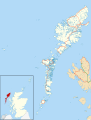
Blank map of the Outer Hebrides (excluding Sula Sgeir), UK with the following information shown:
Equirectangular map projection on WGS 84 datum, with N/S stretched 180% Geographic limits:
|
| 日付 | |
| 原典 |
|
| 作者 | Nilfanion, created using Ordnance Survey data |
| 許可 (ファイルの再利用) |
このファイルはクリエイティブ・コモンズ 表示-継承 3.0 非移植ライセンスのもとに利用を許諾されています。 帰属: Contains Ordnance Survey data © Crown copyright and database right
|
| その他のバージョン | File:Outer Hebrides UK blank map.svg - Blank map |
ファイルの履歴
過去の版のファイルを表示するには、その版の日時をクリックしてください。
| 日付と時刻 | サムネイル | 寸法 | 利用者 | コメント | |
|---|---|---|---|---|---|
| 現在の版 | 2010年9月26日 (日) 20:23 | | 1,083 × 1,424 (3.25メガバイト) | Nilfanion | {{Information |Description=Blank map of the Outer Hebrides (excluding Sula Sgeir), UK with the following information shown: *Administrative borders *Coastline, lakes and rivers *Roads and railways *Urban areas Equire |
ファイルの使用状況
以下の 6 ページがこのファイルを使用しています:
グローバルなファイル使用状況
以下に挙げる他のウィキがこの画像を使っています:
- ar.wikipedia.org での使用状況
- bg.wikipedia.org での使用状況
- ceb.wikipedia.org での使用状況
- de.wikipedia.org での使用状況
- en-two.iwiki.icu での使用状況
- Outer Hebrides
- Stornoway Airport
- Lochboisdale
- Daliburgh
- Callanish
- Stornoway
- Kisimul Castle
- Uig, Lewis
- Rodel
- RRH Benbecula
- Leverburgh
- Castlebay
- Balivanich
- Cladh Hallan
- Back, Lewis
- Knock, Isle of Lewis
- Ardmore, Barra
- Ness, Lewis
- Barra Airport
- Portnaguran
- Aignish
- Dun Carloway
- Shawbost
- Gravir
- Barvas
- Garenin
- Achmore, Lewis
- Aird, Lewis
- Ardhasaig
- Balallan
- Bragar
- Lochmaddy
- Hushinish
- Carloway
- Tarbert, Harris
- Benbecula Airport
- Northbay
- Sollas
- Howmore
このファイルのグローバル使用状況を表示する。