
ファイル:170904 Blindengarten Bad Homburg 3.jpg
このプレビューのサイズ: 800 × 450 ピクセル。 その他の解像度: 320 × 180 ピクセル | 640 × 360 ピクセル | 1,024 × 576 ピクセル | 1,280 × 720 ピクセル | 2,560 × 1,440 ピクセル | 5,312 × 2,988 ピクセル。
元のファイル (5,312 × 2,988 ピクセル、ファイルサイズ: 5.27メガバイト、MIME タイプ: image/jpeg)
ウィキメディア・コモンズのファイルページにある説明を、以下に表示します。
|
概要
| 解説 |
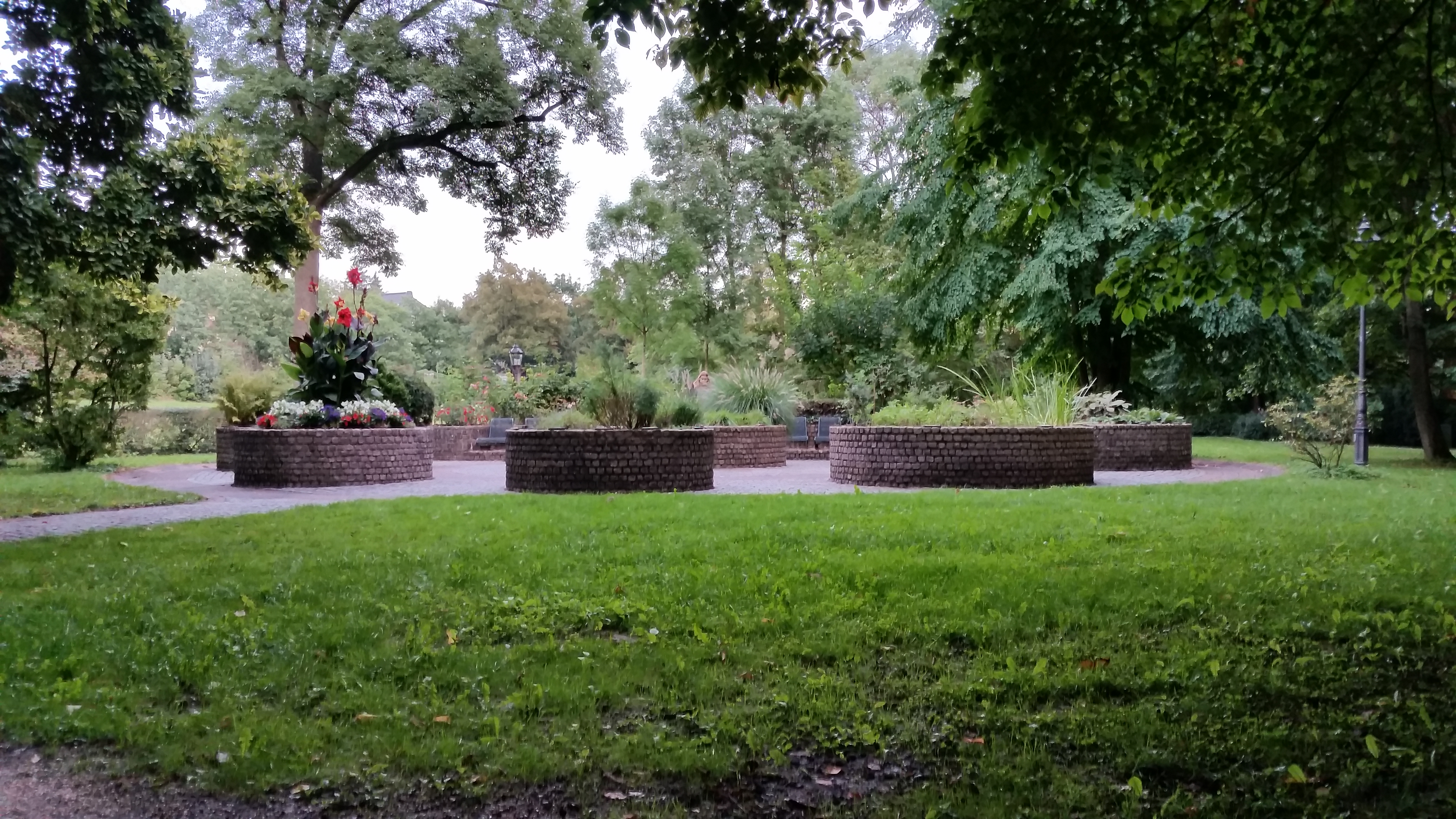
Deutsch: Seit 1983 gibt es den Duft- und Tastgarten im Nordosten vom Kurpark von Bad Homburg - errichtet von der Stadt Bad Homburg und dem Gartenclub Bad Homburg. Acht Hochbetten sind mit Pflanzen zu unterschiedlichen Themen bepflanzt: Küchenkräuter, Heilkräuter, Stauden, Laubgehölze, Rosen, Nadelgehölze und Farne, Sommerblumen, Gräser. Schilder nennen deren Namen und Erläuterungen in "Klarschrift" und in Brailleschrift. Dadurch wird der Blindengarten auch zu einem Lehrgarten. [1]
English: The Odour- and Touch-Garden was built in 1983 by the city of Bad Homburg and the garden club of Bad Homburg. 8 Raised-bed's are planted with plants of differing topics, e.g. culinary herbs, medicinal herb, shrubs, grass, etc. Each plant has its own plaque with its name and explanation - in standard writing and Braille. So the Sensory Garden becomes a teaching and demonstration garden - for every one, including blind person as well. [2] |
| 日付 | |
| 原典 | 投稿者自身による著作物 |
| 作者 | 4spring |
| カメラの位置 | | 以下のサービスでこの位置を確認する: オープンストリートマップ |
|---|
|
The photographical reproduction of this work is covered under the article § 59 of the German copyright law, which states that "It shall be permissible to reproduce, by painting, drawing, photography or cinematography, works which are permanently located on public ways, streets or places and to distribute and publicly communicate such copies. For works of architecture, this provision shall be applicable only to the external appearance."
As with all other “limits of copyright by legally permitted uses”, no changes to the actual work are permitted under § 62 of the German copyright law (UrhG). See Commons:Copyright rules by territory/Germany#Freedom of panorama for more information.
|
Standort: N 50° 13.662 E 008° 37.777 / 50.2277 8.62962
ライセンス
この作品の著作権者である私は、この作品を以下のライセンスで提供します。
| このファイルはクリエイティブ・コモンズ CC0 1.0 全世界 パブリック・ドメイン提供のもとで利用可能にされています。 | |
| ある作品に本コモンズ証を関連づけた者は、その作品について世界全地域において著作権法上認められる、その者が持つすべての権利(その作品に関する権利や隣接する権利を含む。)を、法令上認められる最大限の範囲で放棄して、パブリック・ドメインに提供しています。
この作品は、たとえ営利目的であっても、許可を得ずに複製、改変・翻案、配布、上演・演奏することが出来ます。 |
ファイルの履歴
過去の版のファイルを表示するには、その版の日時をクリックしてください。
| 日付と時刻 | サムネイル | 寸法 | 利用者 | コメント | |
|---|---|---|---|---|---|
| 現在の版 | 2017年12月30日 (土) 05:43 | | 5,312 × 2,988 (5.27メガバイト) | 4spring | User created page with UploadWizard |
ファイルの使用状況
以下のページがこのファイルを使用しています:
グローバルなファイル使用状況
以下に挙げる他のウィキがこの画像を使っています:
- ar.wikipedia.org での使用状況
- en-two.iwiki.icu での使用状況
- es.wikipedia.org での使用状況