利用者:Krorokeroro/sandbox/ehime
表示
1979年、当時の仲野和町長が伊予灘町への町名変更を企図したが強い反対にあい撤回するも反対運動がやまず、任期途中で町長を辞職し町民に信を問うことになった。仲野和と町名変更反対派が推す丸山勇三の2人が立候補し[1]
2001年6月6日から愛媛県町村会長(2003年4月29日まで)[2]。
- 国領川
- 車屋橋
Birmingham, Alabama | ||
|---|---|---|
| City of Birmingham | ||
 From top left: Downtown from Red Mountain; Torii in the Birmingham Botanical Gardens; Alabama Theatre; Birmingham Museum of Art; City Hall; Downtown Financial Center | ||
| ||
|
愛称: "The Magic City", "Pittsburgh of the South", "Bham" | ||
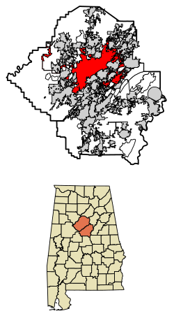
 Location within Jefferson County and Shelby County | ||
| 座標:北緯33度39分12秒 西経86度48分32秒 / 北緯33.65333度 西経86.80889度座標: 北緯33度39分12秒 西経86度48分32秒 / 北緯33.65333度 西経86.80889度 | ||
| 国 |
| |
| 州 | アラバマ州 | |
| 郡 | ジェファーソン郡, シェルビー郡 | |
| 法人化 | December 19, 1871 | |
| 名の由来 | イングランド バーミンガム | |
| 政府 | ||
| • 種別 | Mayor–council | |
| • Mayor | Randall Woodfin (D) | |
| • Council | Birmingham City Council | |
| 面積 | ||
| • City | 148.61 mi2 (384.91 km2) | |
| • 陸地 | 146.07 mi2 (378.32 km2) | |
| • 水域 | 2.55 mi2 (6.59 km2) | |
| 標高 | 644 ft (196 m) | |
| 人口 | ||
| • City | 212,237人 | |
| • 推計 (2018)[3] | 209,880人 | |
| • 順位 |
US: 107th AL: 1st | |
| • 密度 | 1,436.86人/mi2 (554.77人/km2) | |
| • 都市部 | 749,495 (US: 55th)人 | |
| • 都市圏 | 1,151,801 (US: 49th)人 | |
| 族称 | Birminghamian | |
| 等時帯 | UTC−6 (CST) | |
| • 夏時間 | UTC−5 (CDT) | |
| ZIP Codes |
35201–35298 | |
| 市外局番 | 205 | |
| Interstates | I-20, I-22, I-59, I-65, and I-459 | |
| Airports | Birmingham–Shuttlesworth International Airport | |
| FIPS code | 01-07000 | |
| GNIS feature ID | 015817 | |
| ウェブサイト | 公式ウェブサイト | |
- ^ “2018 U.S. Gazetteer Files”. United States Census Bureau. June 4, 2019閲覧。
- ^ “Geographic Identifiers: 2010 Census Summary File 1 (G001): Birmingham city, Alabama”. American Factfinder. U.S. Census Bureau. April 17, 2018閲覧。
- ^ 引用エラー: 無効な
<ref>タグです。「USCensusEst2018」という名前の注釈に対するテキストが指定されていません


