
ファイル:China Xinjiang rel location map.svg

元のファイル (SVG ファイル、2,220 × 1,939 ピクセル、ファイルサイズ: 1.46メガバイト)
ウィキメディア・コモンズのファイルページにある説明を、以下に表示します。
|
概要
| 解説 |
Deutsch: Positionskarte von Xinjiang, Volksrepublik China
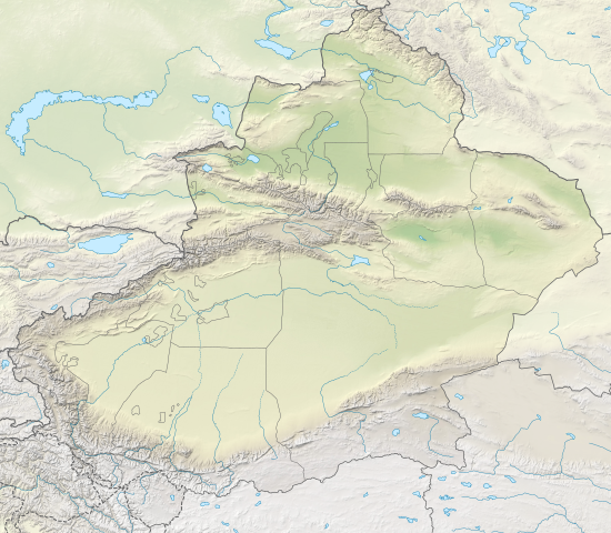
English: Location map of Xinjiang, People's Republic of China
|
||||||||||||
| 日付 | |||||||||||||
| 原典 |
次のものを使用した投稿者自身による著作物::
|
||||||||||||
| 作者 | NordNordWest | ||||||||||||
| その他のバージョン |
|
||||||||||||


|
この地図は、ドイツ語版の(地図研究室)で制作、もしくは改善されたものです。更なる改善の為、地図を提案することもできます。
|
ライセンス
Usage of this file with:

explanatory notes: Legally binding is only the full legalcode. For a free usage I recommend to respect the following licence conditions:
1. Provide my name as given above: NordNordWest,
2. a copy of, or the URI for, the applicable license: https://creativecommons.org/licenses/by-sa/3.0/de/legalcode,
3. the title of the work,
4. in the case of an adaptation, a credit identifying the use of the work in the adaptation.
This license and the rights granted hereunder will terminate automatically upon any breach by you of the terms of this license. Any of the above conditions can be waived if you get permission from the copyright holder. If you have questions or wish differing conditions, please contact me through nnwest or my discussion page ![]() t-online.de
t-online.de
- あなたは以下の条件に従う場合に限り、自由に
- 共有 – 本作品を複製、頒布、展示、実演できます。
- 再構成 – 二次的著作物を作成できます。
- あなたの従うべき条件は以下の通りです。
- 表示 – あなたは適切なクレジットを表示し、ライセンスへのリンクを提供し、変更があったらその旨を示さなければなりません。これらは合理的であればどのような方法で行っても構いませんが、許諾者があなたやあなたの利用行為を支持していると示唆するような方法は除きます。
- 継承 – もしあなたがこの作品をリミックスしたり、改変したり、加工した場合には、あなたはあなたの貢献部分を元の作品とこれと同一または互換性があるライセンスの下に頒布しなければなりません。

ファイルの履歴
過去の版のファイルを表示するには、その版の日時をクリックしてください。
| 日付と時刻 | サムネイル | 寸法 | 利用者 | コメント | |
|---|---|---|---|---|---|
| 現在の版 | 2020年2月14日 (金) 20:05 | | 2,220 × 1,939 (1.46メガバイト) | NordNordWest | == {{int:filedesc}} == {{Information |Description= {{de|1=Positionskarte von Xinjiang, Volksrepublik China}} {{en|1=Location map of Xinjiang, People's Republic of China}} {{Location map series N |stretching=135 |top=49.4 |bottom=34.2 |left=73.2 |right=96.7 }} |Source={{Own using}} * United States National Imagery and Mapping Agency data * World Data Base II data * ETOPO1 data |Date=2020-02-14 |Author={{U|NordNordWest}} |Permission= |other_versions=<gallery>China Xinjiang adm location map.svg<... |
ファイルの使用状況
以下の 36 ページがこのファイルを使用しています:
- アイリク湖
- エビ湖
- オアシス都市
- カラクル湖 (タジキスタン)
- ガッシャーブルムII峰
- ガッシャーブルムIV峰
- ガッシャーブルムI峰
- キジル石窟
- サウイル・スオタシ
- サリム湖
- シルクロード
- スイアブ
- スバシ故城
- タリム盆地
- ニヤ遺跡
- ブロード・ピーク
- ボゴダ山
- ボゴダ峰
- ミーラン遺跡
- ロプノール
- 于田地震
- 交河故城
- 大谷探検隊
- 天山山脈
- 天池 (天山)
- 安西大都護府
- 新疆天山
- 東トルキスタン
- 楼蘭
- 皇冠山
- 西域
- 陽関
- Template:Location map China Xinjiang
- Template:西域地図
- モジュール:Location map/data/China Xinjiang
- モジュール:Location map/data/China Xinjiang/doc
グローバルなファイル使用状況
以下に挙げる他のウィキがこの画像を使っています:
- bh.wikipedia.org での使用状況
- bn.wikipedia.org での使用状況
- cv.wikipedia.org での使用状況
- de.wikipedia.org での使用状況
- Tocharische Sprachen
- Tian Shan
- Kongur
- Kunlun
- Khan Tengri
- Muztagata
- Lop Nor
- Dsungarische Pforte
- Altun
- Kanasi
- Bosten-See
- Turpan-Senke
- Karakol (See)
- Prschewalski-Gebirge
- Ulugh Muztagh
- Wuluwati-Talsperre
- Tiemen Guan
- Pulu-Vulkan
- Ashi-Vulkan
- Wikipedia:Kartenwerkstatt/Positionskarten/Asien
- Kumtag-Wüste (Dunhuang)
- Shaksgam-Tal
- Aydingkol-See
- Vorlage:Positionskarte China Xinjiang
- Ulungur-See
- Jilintai-Talsperre
- Tarbagataigebirge
- Saurgebirge
- Ebinur-See
- Sayram-See
- Bogda Shan
- Borochoro
- Birliktau
- Changtok Sar I
- Sarpo-Laggo-Gletscher
- Urdokgletscher
- Nördlicher Gasherbrumgletscher
- Skamrigletscher
- Kongur Jiubie
- Kotaklik Shan
- Selik Gulam Muztag
- Bukadabang Feng
- Aksai Chin (See)
- Chakragil
- Koskulak Tagh
- Kokosel Tagh
このファイルのグローバル使用状況を表示する。