
「ロゼール県」の版間の差分
m Bot作業依頼: 翻訳用出典テンプレートのsubst展開 (Template:Cite web/French) - log |
|||
| 77行目: | 77行目: | ||
参照元:SPLAF<ref>http://splaf.free.fr/ "splaf"</ref>、2006年以降[[INSEE]]<ref> |
参照元:SPLAF<ref>http://splaf.free.fr/ "splaf"</ref>、2006年以降[[INSEE]]<ref> |
||
{{cite web2|title=Recensement de la population au 1{{er}} janvier 2006|url=http://www.insee.fr/fr/ppp/bases-de-donnees/recensement/populations-legales/departement.asp?dep=48&annee=2006|website=[[:fr:Institut national de la statistique et des études économiques|Insee]]|publication-date=}}</ref>、2007年以降[[INSEE]]<ref name="Struct"> |
|||
{{Lien web |
|||
| ⚫ | {{cite web2|title=Évolution et structure de la population du département (de 1968 à 2007)|url=http://www.recensement.insee.fr/chiffresCles.action?codeMessage=5&zoneSearchField=LOZERE&codeZone=48-DEP&idTheme=3&rechercher=Rechercher|website=[[:fr:Institut national de la statistique et des études économiques|Insee]]</ref> |
||
|url=http://www.insee.fr/fr/ppp/bases-de-donnees/recensement/populations-legales/departement.asp?dep=48&annee=2006 |
|||
|titre=Recensement de la population au 1{{er}} janvier 2006 |
|||
|site =[[:fr:Institut national de la statistique et des études économiques|Insee]] |
|||
}}</ref>、2007年以降[[INSEE]]<ref name="Struct"> |
|||
{{Lien web |
|||
| ⚫ | |||
|titre=Évolution et structure de la population du département (de 1968 à 2007) |
|||
|site =[[:fr:Institut national de la statistique et des études économiques|Insee]] |
|||
consulté le= 11 septembre 2010}}</ref> |
|||
== 観光 == |
== 観光 == |
||
2021年4月15日 (木) 22:54時点における版
| ロゼール県 Lozère | |
|---|---|
 ロゼール県章 | |
| 位置 | |
 | |
| 概要 | |
| 県番号 | 48 |
| 地域圏 | オクシタニー |
| 県庁所在地 | マンド |
| 郡庁所在地 | フロラック=トロワ=リヴィエール |
| 郡 | 2 |
| 小郡 | 25 |
| コミューン | 185 |
| 県議会議長 |
ソフィー・パンテル フランス社会党 |
| 統計 | |
| 人口 国内100位 |
(2011年) 77,156人 |
| 人口密度 | 15人/km2 |
| 面積¹ | 5,167 km2 |
| ¹ 「French Land Register data」(1平方キロ以上の湖沼、エスチュアリー、氷河などの水面積除く。 | |
ロゼール県(ロゼールけん、Lozère)は、フランス、オクシタニー地域圏の県である。
由来
ロゼールの名はロゼール山地(Mont Lozère)にちなむ。フランス語では一般的にMont Lozèreは男性名詞であるが、公式使用においてはロゼール県(préfecture de la Lozère)のように、女性名詞としての使用が勝っている。これにはいくつかの理由がある。
- Lozèreというフランス語の単語の最後のeが無音で終わること
- ほぼ大多数の県において川の名前が女性名詞であること
- 名詞が女性である場合-oとなるが、ジェヴォーダン地方の呼び方でロゼールはLouzero。オック語での女性名の末尾と同等である。
- 18世紀のカッシーニ地図ではロゼール山地がla montagne Lozèreと女性名詞で記されている。
- ロゼールはまた、ruisseau de Pomaretという名の小さな河川にも名前を与えている。その川はロゼール山地に源を発し、ローヌ川支流のアルティエ川に注ぐ。
歴史
ロゼール県は、1790年3月4日に新設された83の県のうちの1つである。県は、かつてのラングドック州の旧ジェヴォーダン司教座管区にほぼ正確に対応している。
地理

ロゼールはラングドック=ルシヨン地域圏で最も北の県である。中央高地の南部を占めている。
北部マルジュリド地方は花崗岩質で、深い森に覆われている。森、草原、荒地、小川が点在する広大な牧草地である。高原は巨大な花崗岩の岩だらけである。
北西部はオーブラック地方である。アヴェロン県北部とカンタル県南部にまたがり、川や湖の多い玄武岩質の高原である。
南東部のセヴェンヌ地方は、エグアル山地とロゼール山地の間に挟まれた、鎖状の片岩地帯である。ローヌ川に近接した河川のおかげで非常に丘が多い。
南西部はグラン・コース地方である。オーブラック地方よりわずかに狭いが標高が高い高原である。多数の陥没した穴や洞窟が見られる。この地方はタルヌ川渓谷によって2つに分断され、アヴェロン県の南部へ伸びている。
面積の大半が山岳地帯で占められ産業も乏しかったため歴史的に人口密度が低い過疎地帯であったが、19世紀後半以降になると更に人口減少が進んだ。2010年にはフランス下院の小選挙区再編成が実施され、ロゼール県は数少ない全県1区となった。
人口統計
| 1801年 | 1831年 | 1841年 | 1851年 | 1856年 | 1861年 | 1866年 |
|---|---|---|---|---|---|---|
| 126.503 | 140.347 | 140.788 | 144.705 | 140.819 | 137.367 | 137.367 |
| 1872年 | 1876年 | 1881年 | 1886年 | 1891年 | 1896年 | 1901年 |
| 135.190 | 138.319 | 143.565 | 141.264 | 135.517 | 132.151 | 128.016 |
| 1906年 | 1911年 | 1921年 | 1926年 | 1931年 | 1936年 | 1946年 |
| 128.016 | 122.738 | 108.822 | 104.733 | 101.849 | 98.480 | 90.523 |
| 1954年 | 1962年 | 1968年 | 1975年 | 1982年 | 1990年 | 1999年 |
| 82.391 | 81.868 | 77.258 | 74.825 | 74.294 | 72.825 | 73.509 |
| 2006年 | 2007年 | 2010年 | ||||
| 76.806 | 76.880 | 77.082 |
参照元:SPLAF[1]、2006年以降INSEE[2]、2007年以降INSEE[3]
観光
ギャラリー
-
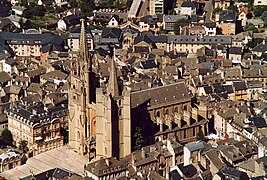 マンド
マンド -
 ダルジラン洞窟
 -
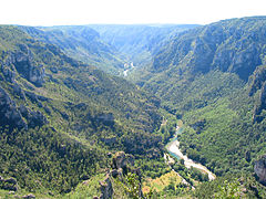 タルヌ川渓谷
 -
 セヴェンヌ山脈


脚注
- ^ http://splaf.free.fr/ "splaf"
- ^
"Recensement de la population au 1er janvier 2006". Insee.
{{cite web}}: Cite webテンプレートでは|access-date=引数が必須です。 (説明) - ^ {{cite web2|title=Évolution et structure de la population du département (de 1968 à 2007)|url=http://www.recensement.insee.fr/chiffresCles.action?codeMessage=5&zoneSearchField=LOZERE&codeZone=48-DEP&idTheme=3&rechercher=Rechercher%7Cwebsite=Insee
- ^ “いつも心に冒険を。探検したくなる「世界の洞窟」20選”. ViRATES. 2018年5月5日閲覧。